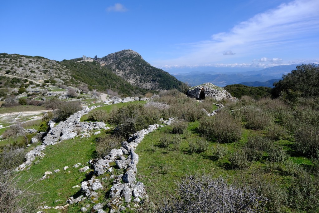
A hike around the three Alexandros villages visiting several points of interest on the way. The trail is mostly on quiet roads and unpaved track with a short section on a monopati climbing up on stony ground. Wear shoes suitable for off-paving conditions. Also wise to carry some water. Allow an hour plus stops.
The trail is marked with an arrow on a green circular marker. For part of the route in the trees it shares another path marked with red/orange paint on the rocks.
Taverna and accommodation in Kolyvata. Accommodation in Alexandros.
The trail starts by the old schoolhouse on the way into Alexandros village as you come from Lefkada Town. There is plenty of room for parking. Take a look at the schoolhouse and the windmill up on the low hill. When ready walk along the road into Alexandros village.
Entering Alexandros village with Agios Demetrios up the white steps to the right.
Shortly after the first bend to the right you pass Agios Demetrios church up on the right. Continue to where the road turns left close to a group of houses and enters the Village Square. Take a short detour to look around the traditional homes of the village. Agios Spiridon church is also in the square.
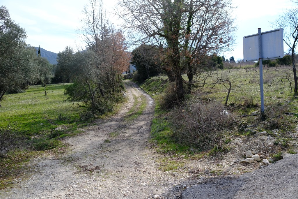
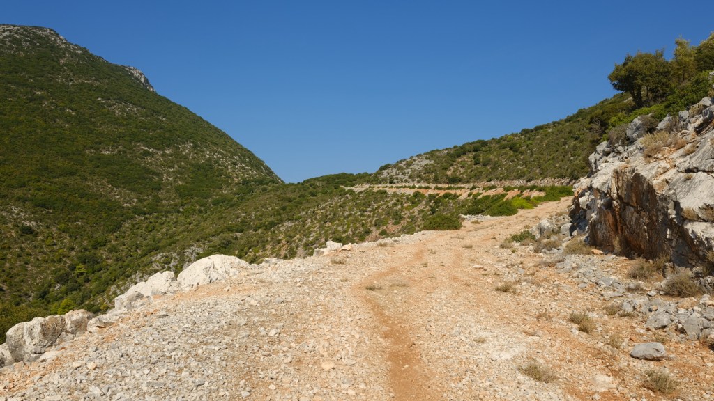
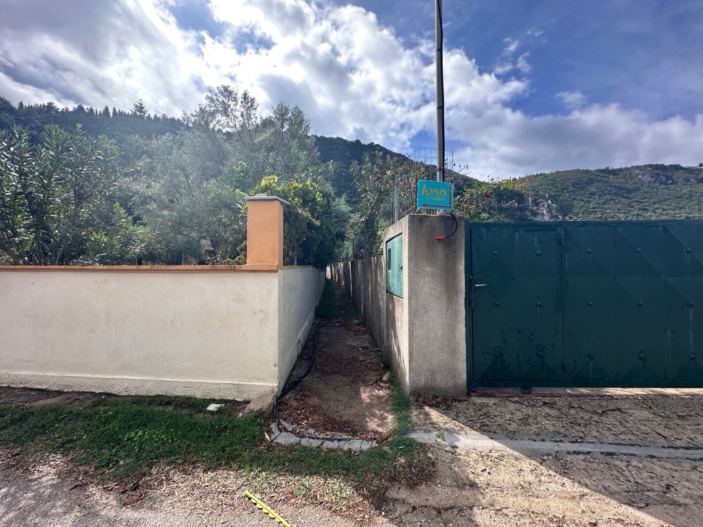
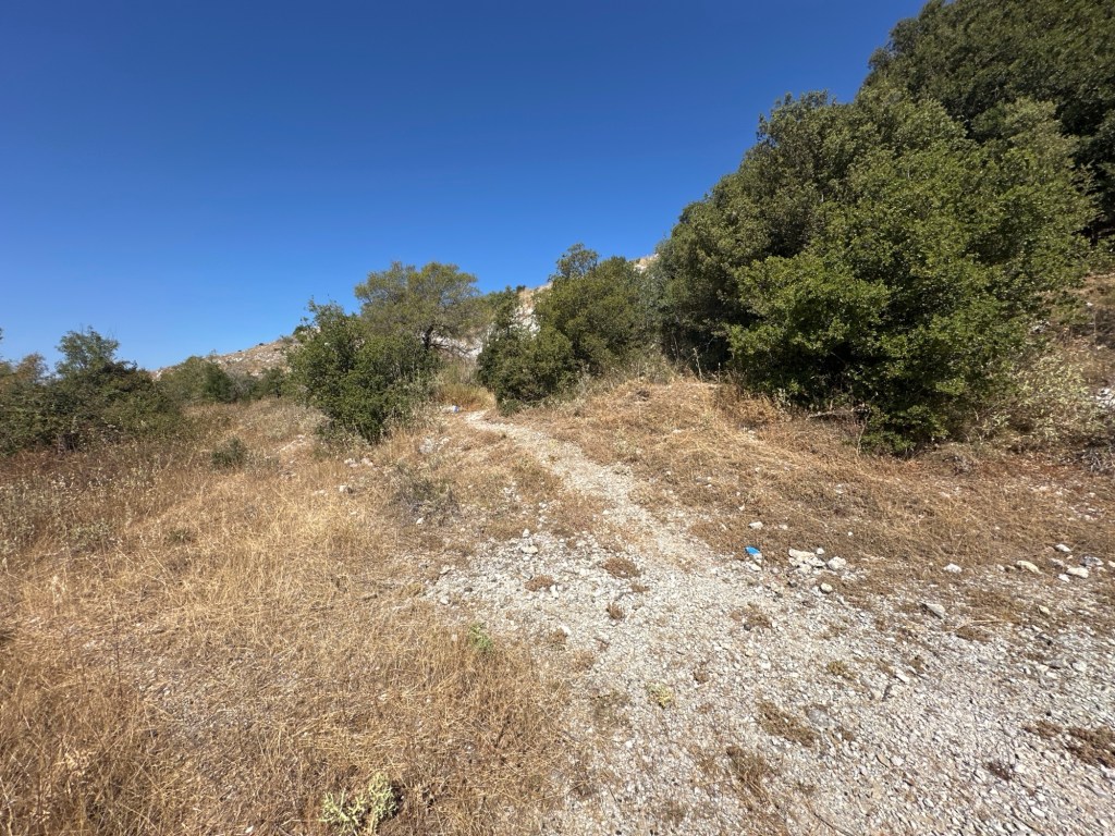
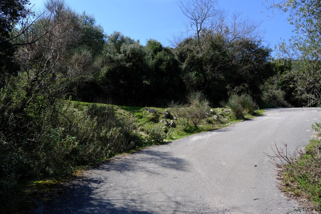
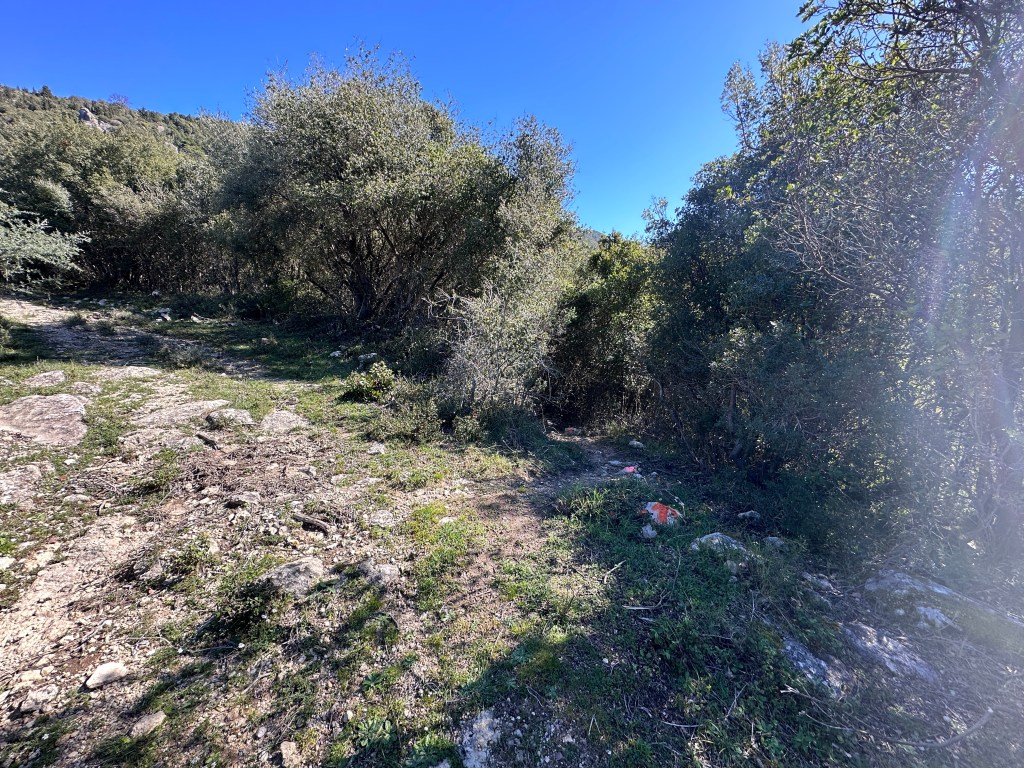
After looking around go back to the road where you entered the square and head right downhill. After a few more houses you cross the small agricultural plain and head out of the village. Just past the village exit sign you pass a track going off left.
The track goes off left as you exit Alexandros village.
You will shortly go down that track, but it is well worth walking a hundred metres further to see the small church of Panagia Alexandritissa. Just past the church nestles the hamlet of Kiafa up on the low hill in the trees.
Panagia Alexandritissa just beside the hamlet of Kiafa
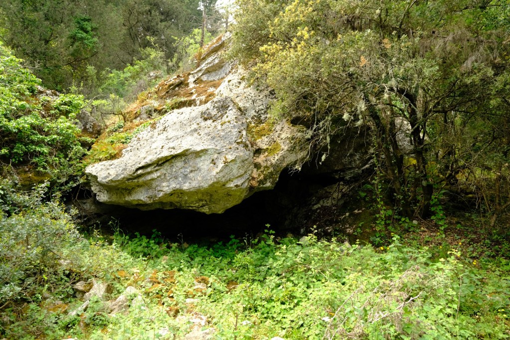
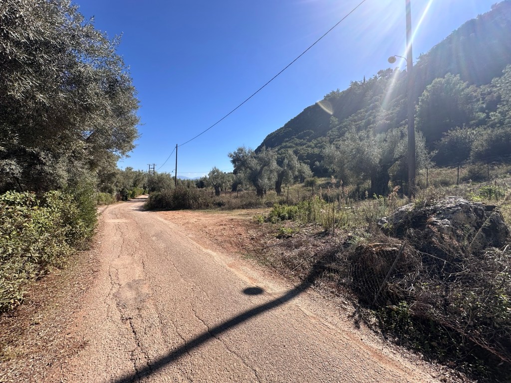
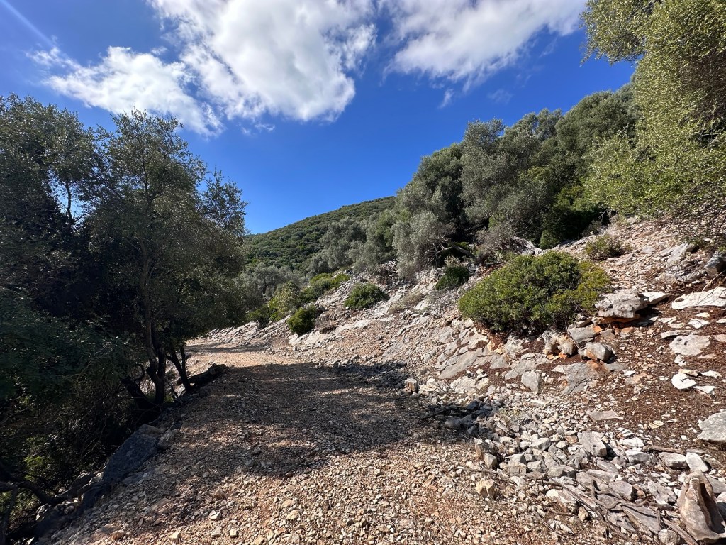
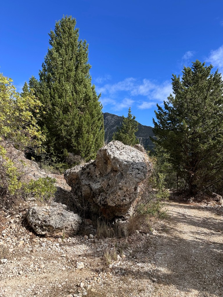
Return to the track going left (now right) and head off down the track. Keep right at both forks, heading downhill through the wonderful pine forest. After 300m you pass a cave in the trees on the right.
Pass a cave on the right.
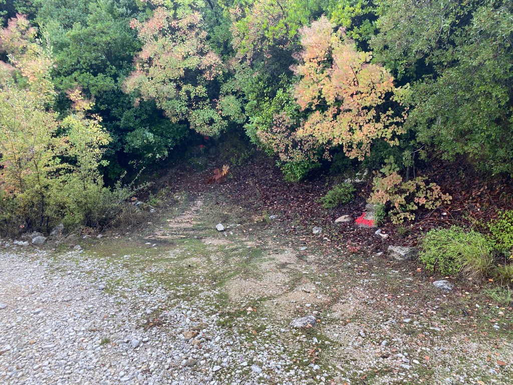
You start to descend a little steeper. Keep left on the track where it hairpins left and then right ignoring the side turnings. You soon cross a small bridge across a stream and start to climb. Almost immediate there is another track going sharp left, take that track. There is a small brick blockhouse on the left. This part of the trail has red painted markers to show you the way.
Keep on through the trees keeping right at the fork. Eventually the track goes over a stream. Cross over (there is rarely much water) and keep on the path going straight across the clearing. You will go up the hill straight ahead, but take a while to look at the shady Spring on the left side of the clearing.
The track crosses a clearing and heads up the rocky slope straight ahead.
When ready follow the path going up the rocky slope ahead of you. The red painted blobs help show the way. Take care on the slope but it is a pretty easy climb up. At the top the path continues straight on through the trees.
The path runs through the trees heading into Kolyvata.
Ignore any turnings left or right, and keep straight on until you pass into some houses. Follow the path as it climbs a concrete ramp into the centre of Kolyvata. Take a while to look at this charming village.
When ready continue on the road where you entered the village as it winds around a few curves and comes to a junction. Off right is the road to Nikiana, but you keep left and walk another 300m back to the schoolhouse where you parked your car.
A hike on the small island of Kalamos, east of Lefkada and close to the mainland. The trail ascends to the tiny church of Agia Paraskevi high on a pass between the two main mountains of the island. There are breath-taking views from the top.
Ferries to Kalamos from Lefkada Town or from Mytikas on the mainland. It is possible to hire a boat for you or a skipper to cross from Mytikas.
Accommodation and tavernas on Kalamos.
The hike starts from Kalamos main port on the south-east side of the island. The port is usually busy with visiting yachts and flotillas vying for space to moor for the night. There are shops to stock up with water and cheese pies for your hike.
Set off up the road leading up into the town from the port. After 30m turn left up a steep path.
The steep path leading up from the port.
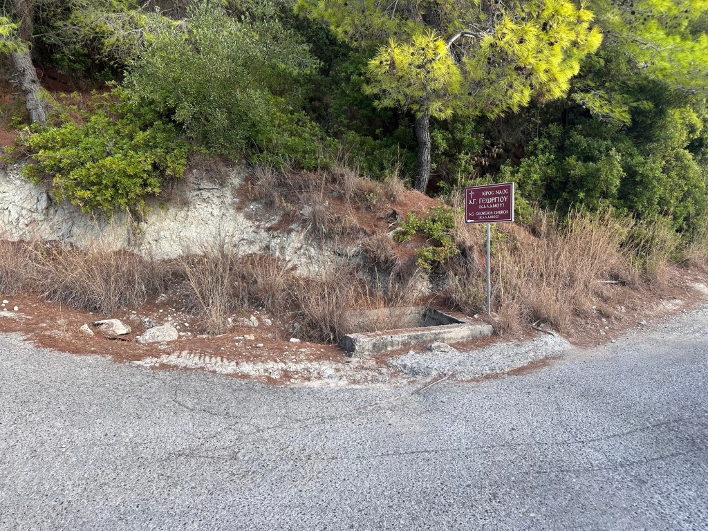
After two bends fork right, and then take the first narrow road going right. After a short distance you join another road where the route straight on is marked “no through way” – a path goes left straight up the hill between two houses. After the houses go right along the road.
The first turning left up to Ag Georgios church.
The road heads along to coast slowly climbing. After 800m there is a road going sharp left back up the hill signposted to Ag Georgios church – take that road. After 400m a track goes sharp right also signposted to the church. After 300m you pass the church keeping to the right onto the track as it starts to ascend the mountain.
Looking back down towards the port.
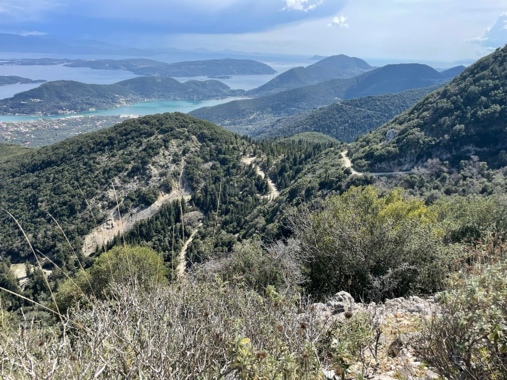
You now climb up through olive groves then pine forest getting higher and higher. The track turns to the right and then left as it zig-zags up the hill. You are heading for the top of the pass between the mountains up ahead.
The track climbs up to the pass.
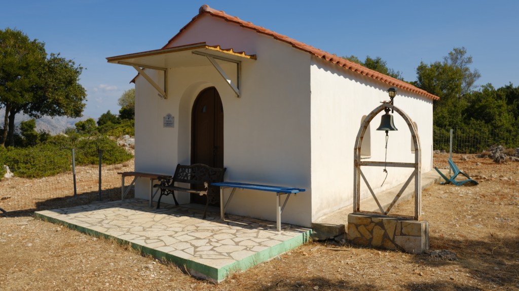
At the top the track goes a short way to the right where is the tiny church of Panagia Agia Paraskevi. There are a few benches outside and it is a very pretty spot to sit and eat those cheese pies. You get views in both directions to the south and north.
Tiny church of Agia Paraskevi
The church is of St Friday, an early Christian martyr. A wonderful spot. When you have rested retrace your steps back down to the port.
On the map are two other marked paths, one ascending the mountain to the right, and the other descending the pass on the other side. Both of these paths are very hard to follow on the ground, and cross extremely rough ground with thick vegetation. We cannot recommend either, unfortunately, after having tried them both. The path down was blocked by discarded cuttings when electric workers repaired the transmission lines. We will update this website if the path is repaired.
This trail combines visits to two historic locations important to Christians on Lefkada, with a visit to two amazing beaches. The walk starts and ends 2km to the west of Lefkada Town, and you can walk or take your car and park by the beach.
Christianity came to Lefkada very early, in AD 65 only 32 years after Jesus’s death. This trail follows the footsteps of the first Christians on Lefkada. It starts where they traditionally landed on the beach, and climbs to the first sanctuary, later monastery, high on the headland. The trail returns to the beach via a different path ending at a beach taverna.
The trail is short but climbs a fairly steep path up and a slightly less steep path back down. It is best to treat as a short hike rather than a walk.
Just 2km outside Lefkada Town, either walk, take your car or a short taxi ride.
Lots of accommodation and tavernas in Lefkada Town. Tavernas too at the beaches at the start and end of the walk.
The trail starts on the Agios Ioannis beach on the western edge of Lefkada Town. Park anywhere on the side of the road. Start by walking west along to the end of the beach at a rocky headland.
Agios Ioannis beach and headland where this trail starts and ends.
Just up from the end of the beach is the small church of Agios Ioannis Antzousi. This was the starting place of Christianity on Lefkada in 65 AD. According to tradition St Paul preached in a cave where the church is built.
Agios Ioannis Antzousi, founded in 65 AD, rebuilt later by the Franks.
It is known that Paul travelled through western Greece, spreading Christianity from Macedonia to the Ionian coast. He reached Nicopolis, the new Roman city, and spent the winter of 64-65 AD. This much is documented, and it is entirely possible he came to Lefkada. Indeed he travelled by ship which would have gone through the Lefkada canal. According to Lefkadian tradition, Paul came with his disciple Sosion, and later ordained him as the island’s first bishop.
A small church was built and dedicated to Saint John the Baptist, and known today as the church of Agios Ioannis Antzousi. Carved partly into the rock and shaded by olives, the chapel remains one of the island’s oldest sacred sites. Centuries later, the Angevin (Anjou) knights who ruled Lefkada restored it, giving it the name “Antzousi.” With its rough stone roof and quiet setting above the sea, it still feels like a place where the earliest Christians might have gathered in secrecy.
After viewing the church retrace your steps just past the Telegaphos Taverna. Continue along the beach for a short distance and take a small turning on the right, next to the beach blue flag and information sign.
Take this small road from the beach.
Keep to the small road as it wiggles through the beach houses for a few hundred metres. When you come to a greener area with olive trees take a track going right. It wiggles right then left and comes to a road. Straight over the road is a narrow path between walls.
Take the narrow path between walls.
Take the path to a second road. Turn left and walk below the cliffs to an olive grove on the right. Take the track running on the right of a metal fence straight up a slope. At the top a monopati goes left and up the steep slope.
Turn right onto the track going up into the olive grove.
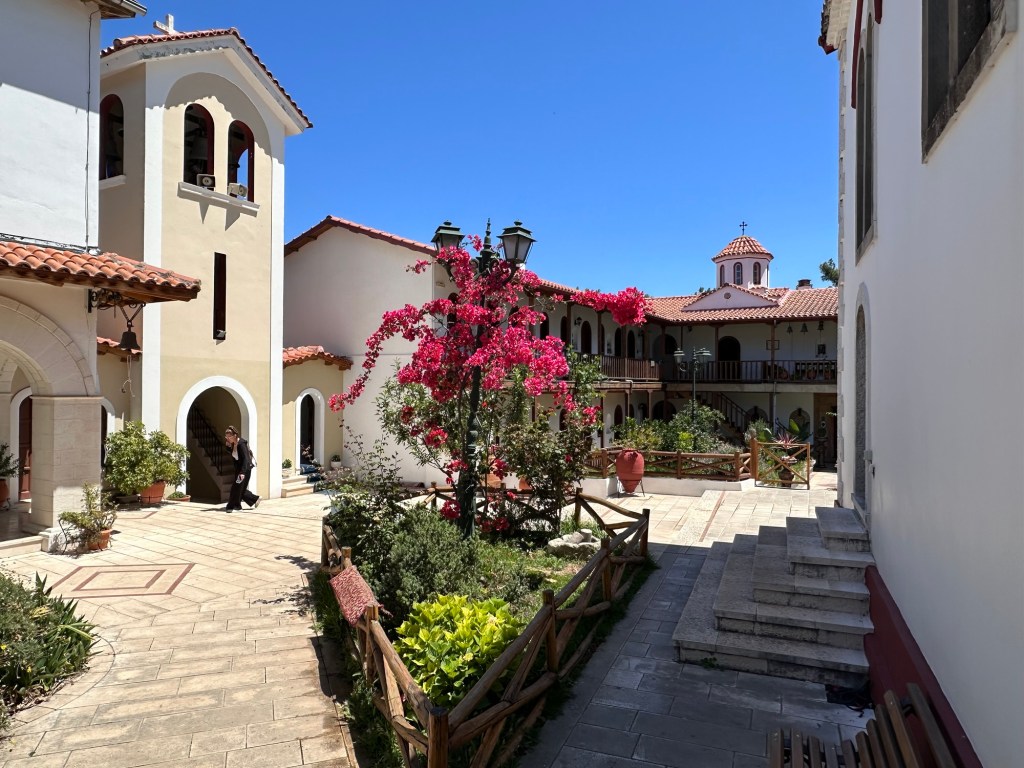
The monopati climbs steeply in zig zags as it traces a route up the hill to the top. As you get higher you get great views back across the bay below. As you get to the top you join a track near a gate, go left towards the road and the entrance to the monastery. If the monastery is open, the trail runs through the grounds where you can visit the small zoo, the church, a gift shop and a museum, exiting on the north side. If the monastery is shut, go left along the road around to the north gate.
The entrance to the Monastery of Panagia Faneromeni
From the first coastal church, Bishop Sosion and the early believers moved inland. Climbing the wooded hill above the first church, they found an ancient temple of Artemis. There they built a new church dedicated to the Virgin Mary, marking the birth of Christian Lefkada’s spiritual heart—the Monastery of Panagia Faneromeni. The name, meaning “the Revealed Virgin,” recalls the miracle of an icon of the Virgin that was said to have appeared to the monks who rebuilt the church. Artemis, the ancient god of motherhood and children was replaced by Mary.
By the 4th century AD, the sanctuary had become a monastery, serving as both a place of worship and a refuge for the faithful. Through centuries of Byzantine, Venetian, and Ottoman rule it endured, rebuilt many times after earthquakes and fires, most recently after the great blaze of 1886.
The peaceful monastery gardens.
After you exit the north gate of the monastery, go right a short distance along the road and take the first track off left. This descends in a series of zig zags down the slope. They are not quite so steep as the way up, making your way a little easier.
As you near the bottom of the path a second smaller monopati goes off left. Take this through a last few turns to reach a road along some houses. Go left, take one last turn down, and reach the bottom of the hill. Go straight on across the first crossroads by the small church, walk another 150m and take the first left turn.
After the crossroads take the first turn left.
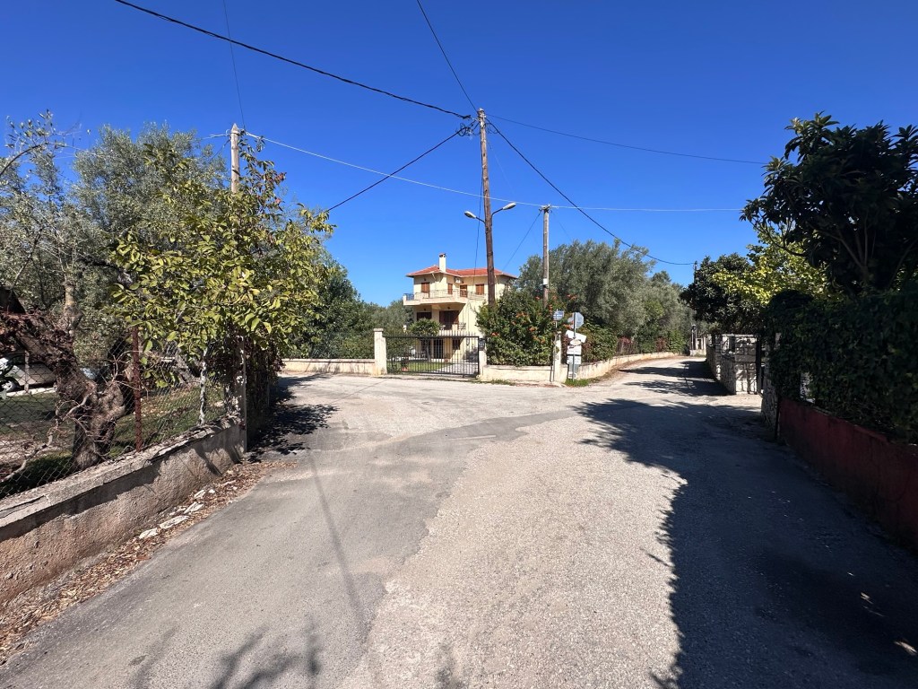
Keep going straight on along the road, ignoring minor turnings. After 400m you pass where you turned off to go up the hill, and then shortly after back to the beach.
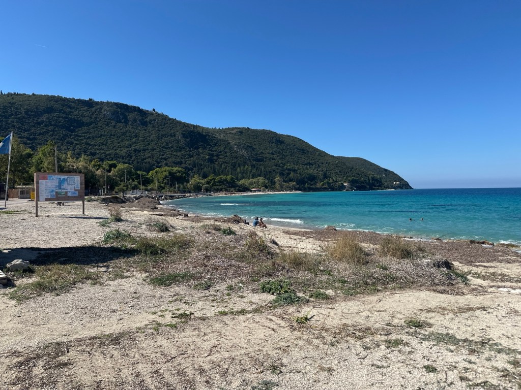
The beach is wonderful with sand and rocks for swimming. To your left are a string of beach tavernas. To the right Agios Ioannis beach merges into Milos Beach with its old windmill towers. This a favoured location for kite-surfing, well worth watching their amazing acrobatics.
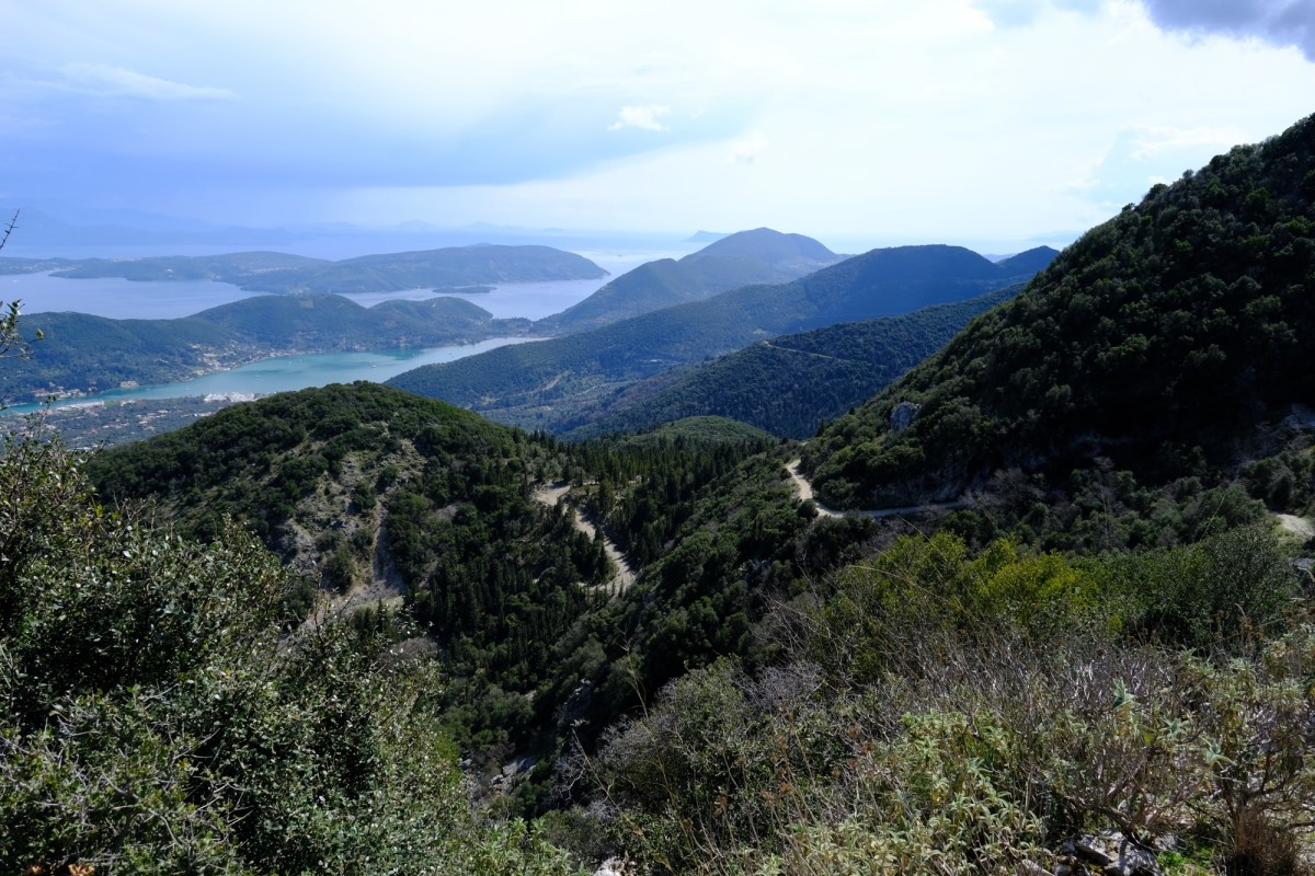
Get the best of two worlds with this loop around a mountain on Meganisi island, starting high level with sweeping views, then back along the coast with coves and beaches. Starts and ends at the port where ferries arrive from Lefkada. Get a morning ferry over, do this walk, and take the late afternoon ferry back to Lefkada. Make sure you leave time for a swim and a fish supper, whilst waiting for the ferry back.
The walk is quite long but along easy tracks and then a road. As always take lots of water. Also your swimming clothes and a towel. It is possible to shorten the walk back, bypassing the walk along the coast. The trail is suitable for a mountain bike, and bikes can be rented in Nidri and Spartochori.
Take the ferry across to Meganisi from Nidri. It runs a few times a day with enough time between morning and later afternoon crossings to do this hike.
Tavernas in Spilia, the Meganisi ferry port. Accommodation and tavernas in Spartochori.
The route starts from Spilia port on Meganisi island where the ferry docks from Lefkada. The ferry runs from Nidri, most of the year three to five times a day – usually with morning and late afternoon ferries. It takes just 20 minutes and is very cheap for foot passengers. Just walk on and pay on board, no need to book. > Check online for the timetables that change every month. There are tavernas in both ports so easy if you have time to kill.
When you come off the ferry, head left on the road as it runs around the bay and starts to climb. After 300m there are some steps on the right that takes a shortcut across the zig-zags of the road. There are then another set of steps doing the same further up. You end up, either by road or steps, in a little square in the village of Spartochori, with great views back to Lefkada.
The village square in Spartochori.
Take the road going up from the square, take the first fork right, then the second left until you reach the main road running through Spartochori with a few shops. Go left along the main road to a T junction where you go left then immediately right. Keep going straight on to a fork by a builders yard where you go right on the smaller road.
Fork right by the builders yard.
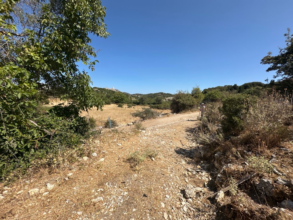
Keep going straight on and forking right, and the small road becomes a track, leaving Spartochori behind. The track runs for 3km down the eastern side of Meganisi, high up on the hill. You climb up further and both the track and the views get better and better. You run through ancient olive groves within water shaped limestone rocks. You get views first north over the mainland, then south east towards the Corinth Gulf, then south down the long tail of Meganisi. This part of the walk is stunning. Part way there is a metal gate across the road. It is easy to untie the rope and open – make sure you close and retie, it keeps animals in.
The track gets better and better.
Shortly after passing the southmost point you pass the track that runs down the long tail of the island. This trail does not go that way as it is only there and back and about 7km each way. Feel free to divert if you are uber fit, otherwise continue on the track as it turns back north.
The start of the track down the long tail of Meganisi. We don’t go that way today, but you should be safe if you walk. It is a dead-end so allow time if you do venture down.
On the west side of the island you run into increasing signs of villa building projects. Unfortunately, this rather detracts from the ambience for a short section. After 1km you get to a fork where the road going left is new tarmac and the right track climbs up. We are going to go left to get down to the coast road, but the right fork is a track going straight back to Spartochori making a shortcut back to the ferry.
Walk left along the new road for 1.3km until you get to a road junction. Go left down the hill (if you go right it is a second shortcut to Spartochori along a road). After a few zig-zags down you reach the sea near a pretty church, a coffee bar and a pebbly beach. When you are ready take the road going right along the coast.
Walking back along the coast road with many great swimming spots.
You follow this coast road now right back to the ferry, 4km. It passes a series of beaches, big and small, as well as beach bars and small tavernas. They are only open in season, but very nice if so. If you walk out of season then it will be quieter but you need to take your own picnic and drink. Take your pick of wonderful places to swim in the clear waters.
After about 3km you get to the headland just before the ferry port. The road heads inland a little, though with nice trees for shade. There are three short climbs, the last one being the longest (don’t worry you are nearly there). At the top of the last hill the road forks – go left and back down and around to the ferry. If you go right it takes you to Spartochori.
The road at the first of three short climbs.
In the bay just past the ferry terminal are several tavernas – all good. A great place to wait for the next ferry. Also a great beach where you can swim safely (marked so boats can’t run you down). Don’t swim where the boats sail or dock.
A hike from the Vasiliki beach town along tracks up into the olive trees and pine forests along the valley leading up to Mount Elati. The halfway point is the almost abandoned village of Roupakias with its pretty church and a rock ravine cut by the river. The trail then heads back to Vasiliki along quiet roads in the base of the valley.
The route is pretty easy along tracks and quiet roads with some gentle hills. It would make a good mountain bike route too. There is quite a lot of shade but, as usual, carry plenty of water. There are quite a few turnings on the trail so we advise, as always, to download the GPX file into your phone app, so you can easily follow along. Route “R” signs mark all but the last section of the trail.
Frequent bus to Vasiliki from Lefkada Town. Walk from Vasiliki to the start of the trail – or park your car at the start.
Plenty of tavernas and accommodation in Vasiliki, it makes a good base for the south of the island.
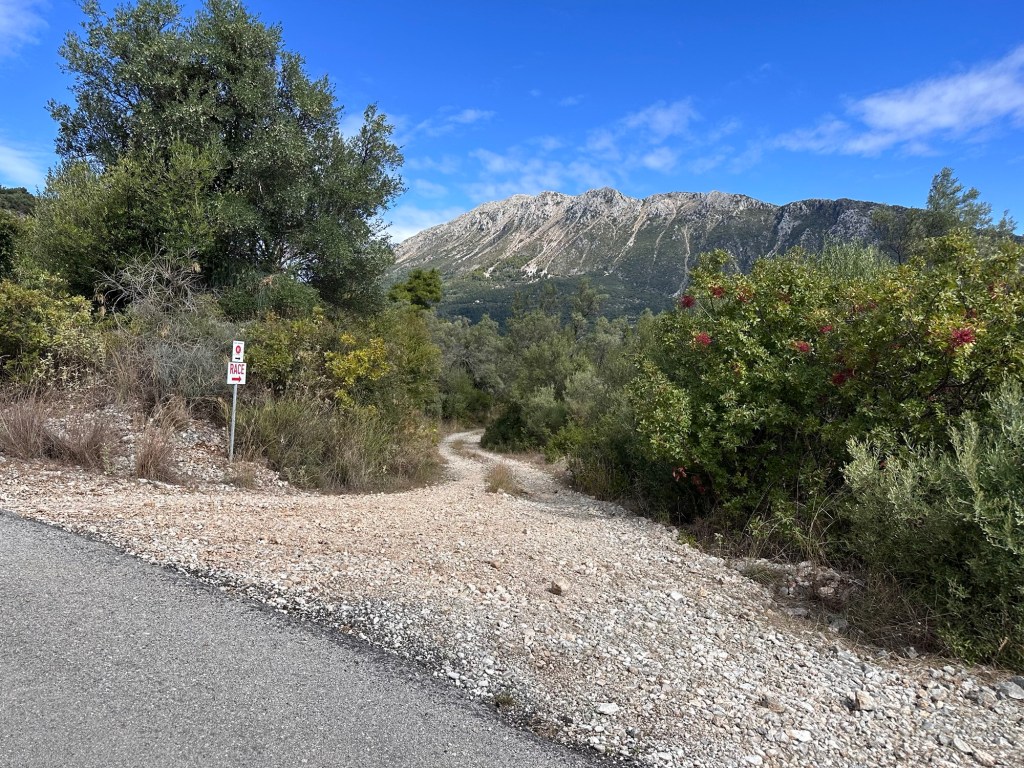
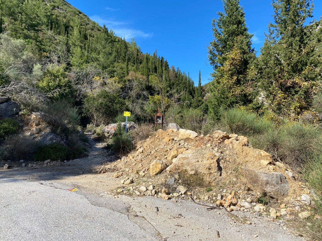
The trail starts 1km from the centre of Vasiliki, easily walked if you are staying in the village. Take the small road turning up the west side of the river running down the centre of the valley (near the Wildwind hotel). After 700m a track goes off left by a white shrine. There is space to park a car taking care not to block any access. The trail starts up the track.
Start of the trail turning off the road by the white shrine.
The route has been well signed by the Vasiliki mountain race organisers. So, for almost all of this trail you will follow the red route “R” signs and red painted dots and arrows. As far as Roupakias you also follow the very clear signs saying “Race”. The race was the 2025 42km marathon from Vasiliki – but take care as race routes sometimes change – while route “R” is less likely to change.
The trail soon becomes pretty and rural running through old olive tree groves and then pine forest. At a T junction bear right and immediately right again at a fork. At a cross roads bear right yet again. After 1km you come to a white painted plane tree in the middle of a track junction with a spring running from the rock behind.
Pass a spring with its white painted plane tree.
Keep straight on up the track passing to the left of the spring. For the next 1.5km keep straight on along the wonderful track. It climbs gently as the scenery becomes better and better. Some of the olive trees are huge and must be many centuries old. The views of Lefkada’s highest mountain Stavrotas, across the valley, become closer and grander. This flank of Stavrotas, with huge screes, thrown up by the geological fault running along the west of Lefkada, is too unstable to be climbed safely, but looks magnificent.
After 1.5km you reach a quiet road. Turn left and climb up a few zig-zags of the road. After about 400m another track goes off right heading directly at Stavrotas. Take the track and enjoy the view.
Turn off the road. Views of Stavrotas mountain across the valley.
The track continues for another 1.5km running across the hillside going gently up and down as it heads along the side of the valley. Ignore all turnings and keep straight along the main track. You pass a huge boulder sitting on one edge at the side of the track.
Pass a huge boulder looking precarious.
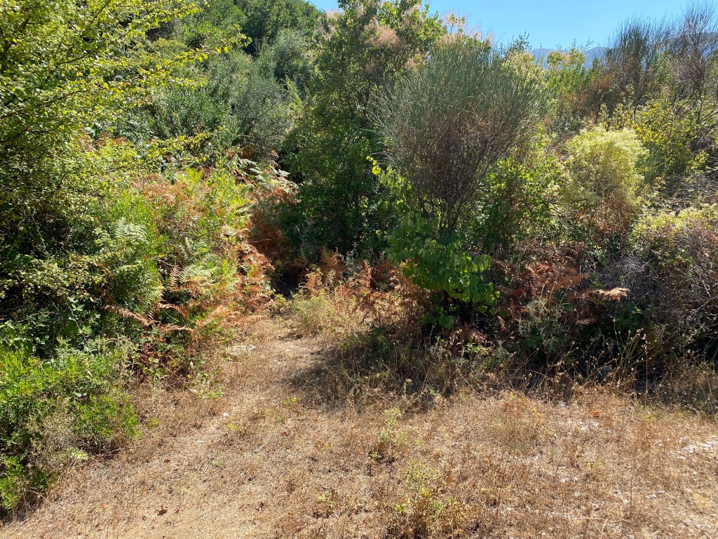
Shortly after the boulder the track becomes a little narrower and part overgrown, but the way through is clear. The track becomes wider again and joins another track coming in from the left. Head right down the slope. After 300m going down take a sharp left. Continue again through huge pines, climbing again a short way until meeting a quiet road. Turn right down the road. After 250m you pass a very pretty church as you start entering the ruined buildings of Roupakias.
Pass the Roupakias church as you enter the village.
Just past the church you reach the bottom of the valley and loop start heading back down the valley. After 100m you pass a few buildings on the right that are still occupied, along with a fine wooden signboard for Roupakias. On the left opposite the sign is a bridge over the stream, well worth a short detour to view the gorge below. The “Race” signs leave us here crossing the bridge.
Beware, there is no handrail or parapet of any kind, just a big drop to the worn rock gully and pools below. If you have young children grab their hands. For much of the second half of summer the stream is dry – in early summer it is possible to swim in some of the pools. There is a track to the river a few hundred metres downstream of the bridge down the road. Take great care on the rocks.
The Roupakias ravine viewed from the bridge, dry at the end of the summer.
Returning back across the bridge, head down the valley on the road. It zig-zags a couple of times and then runs straight down the valley for about 3km. It is very quiet and rural. Eventually the road turns sharp right and then left again after 200m. The road starts to pass various villa building projects. Keep going for another 1km. A sign for route “R” indicates right – but we now leave those signs behind -so go straight on instead. After another 400m take the road fork right. After another 1km the road turns sharp right at a huge double electric pole and transformer – take the track going half-left instead. After 200m you reach a track cross roads beside a smaller single electric pole – go right following the metal fence.
Approaching the track crossroads with single electric pole and metal fence.
Follow the track as it wiggles left and right ignoring the minor turnings into fields and yards. You pass some huge piles of concrete demolition so keep your eyes on the mountains and trees. After 300m or so you return to a road – turn left and follow it.
Keep on the road for 1km through more building projects (perchance finished when you do this walk). You return to the white shrine box at the start of this trail. If you didn’t park your car here keep on for another 700m to the main Vasiliki road.
High above Eglouvi lie the wonderful and unique lentil fields that produce the famous Eglouvi lentils (now DOC protected). Next to the traditional threshing floors is the tiny church of Agios Donatas. Nearby are old stone volti shelters. This route follows the traditional monopati used by villagers over centuries to reach the lentil fields. You can return back the way you came or follow this trail as it explores the lentil fields before descending a gorge back down to Eglouvi.
The first part of the trail up to Agios Donatos is well shaded and possible on a hot day, albeit better evening or first thing. After that there is infrequent shade, but not much ascent. There is no water on the trail.
Tavernas and accommodation in nearby Karya. Tavernas in Eglouvi.
The trail starts in Eglouvi square where are several tavernas. Water from the tap by the plane tree. Go 50m back downhill to the road junction where a paved path climbs steeply to the left. The trail to Agios Donatos is signposted on the wall.
You are going up the M3 to Agios Donatos
You will mostly follow the blue paint blobs, except for a few key sections described below, so don’t follow them without consulting this text. The many coloured routes are each different distances in the Eglouvi mountain races held each year. The village runners have kept these trails open over the years and we are grateful to them. For full continuous guidance download and use the GPX file on your phone or GPS device.
At the forks go left, right, left. Follow the blue paint. Walk up the road towards a church and cemetery and go right up the monopati just before you reach them.
After a short climb behind the cemetery keep right up the steep concrete track. You join a road for a brief way (left then right) and continue up the monopati.
Follow this wonderful monopati as it climbs gently in the shade of trees tended by previous generations. A truly stunning path that used to be the main route between village and the high lentil fields.
After a while you cross the road again, left then right. After 200m the path opens out approaching the top where it forks. Fork right, this time following red not blue paint. The blue returns just after this fork.
Agios Donatos with rock shelters behind
Just after the fork you reach the Ag Donatos church and lentil threshing floors. Behind are rock shelters used in ancient times by the lentil workers. If you are here in the evening of the 6th August each year there will be a lentil festival in full swing with a church service, a thousand people queuing for lentil soup and sardines, and late night music and Greek dancing.
You can simply retrace your steps back down to Eglouvi, many do and it is a good short trail. But the lentil fields are worth visiting too with wonderful views and many wild flowers. The best are in spring and autumn, but even in high summer there are many rock flowers unique to this high plateau.
After looking around, take the track on the opposite side of the road behind the threshing floors following the blue paint marks. Keep left at the fork and climb the low hill.
To your right is an expanse of lentil fields running across and up Stavrotas mountain. If you are here in spring or late autumn this will be green and full of wild flowers and the yellow flowered lentils. In mid summer it will be brown, but still wild and beautiful. The lentils are an important crop with high quality bringing high prices. This preserves traditional life and keeps at bay the Faustian pact of tourist “development”. As a hiker you can appreciate without disrupting.
Firework of flowers from April to May
Ignore turnings into fields and keep straight on the track up the hill. The track ends just before the hill top and becomes a monopati.
End of the track and start of monopati.
The monopati climbs to the top of the hill running right along the low ridge giving little view vignettes in all directions. Look back down to Donatos threshing area and onwards to Mega Oros and Agios Ilias. The path drops off the ridge down to a track. Go first right then almost immediately right.
Join a track, going briefly right, then left.
The track runs through fields then over a low ridge whereafter are views north towards Paxos and sometimes Corfu. Descend the valley keeping on the main track. The track starts to ascend the valley side, steep and gravelly at first. After going over a low ridge you meet a track where you turn left.
Follow the track ignoring field turns and gradually ascend. At the top of a hill turn right and then fork left heading towards the golf-ball shaped radar base.
The track goes off right at the top of a hill.
When the track goes right a monopati goes left straight up the hill. Follow the monopati over a rocky hill and down to the road as it skirts a big quarry. The monopati becomes a track just before reaching the road.
Go left for a short way to the junction where the road goes right up to Profitas Ilias church on the mountaintop. If you have energy it is worth a detour. The trail takes the track going sharp right down across the quarry at the road junction. The blue markers go a different way, but indistinct red markers show your way now.
The track down over the quarry starts at the road junction.
Follow the track as it bridges huge gravel diggings keeping to the right where it forks. You are heading for the stream exit at the bottom right. You join a red yellow painted track as it comes in from the right. Keep down along the dry stream-bed. The blue paint markers re-join too from the left, and the multicolour trail descends towards Eglouvi.
As the stream gorge gets deeper keep to the right side and follow the very clear good path down the gorge. Eglouvi appears below and the Micky Mouse ears of the old NATO microwave relay base are up to your right.
Join the road at the bottom at a hairpin bend. Head down left to the next hairpin where you go straight on along a track towards houses. A paved path goes sharp left down between houses and descends steeply to where you started.
I can strongly recommend the tavernas, you may see Trish and me sitting there post-hike. If you want to try the lentils they sell them, both in packets for you to take home or as various dishes to taste here. They sell out quickly after the late-July harvest, although they save some for the kitchen for you to taste. Beware fakes if you buy them elsewhere.
A wonderful loop walk above Nidri taking you up to the pretty mountain village of Vafkeri, past the charming Agios Asomati monastery and back down by a different track. Along the way are wonderful views back to Nidri and beyond to the islands and Inland Sea.
This makes a great day walk on the mountain above Nidri – through thick forest and across steep slopes. The walk is on a very good track for all but one short section washed away by the rain. There is a taverna at Vafkeri at about half-way along the trail (reports Aug 25 that it is now closed, hopefully not for long).
The trail can be extended along the high level track to Neochori and back to Nidri that way, or as far as Alatro. If on foot from Nidri I suggest getting a taxi to the start and then walk back via Neochori. This is also a route for a mountain bike ride if you can get past the rain damaged section, or if you avoid that by routing via Neochori or Alatro.
You need a car or taxi to take you to the start. It is 6km up from Nidri.
Accomodation and taveras in Nidri. Also a taverna in Vafkeri.
The trail starts 5km up the road from Nidri to Vafkeri – just after the big zig-zag section. You pass one or two villas beside the road and a concrete track goes off left, signposted to several villas. Park without blocking anything and take the concrete track.
The concrete track goes left off the Nidri-Vafkeri road.
After a short distance there are two forks one after another – keep right at both towards Villa El Aquila. Keep climbing up the concrete track. After 850m the concrete track goes up left to the villa itself and an unsurfaced track continues right. The unsurfaced track starts to climb zig-zags up through the rocks and trees. After 1km you start to come into Vafkeri village. Keep going straight on into the village, past a church on your left into the village centre. There is a taverna in the village where you can take a refreshment break.
Just as the track starts to descend steeply a concrete and stone track goes off left sloping down to the road. Go down to the road and turn left.
The concrete and stone track sloping left from Vafkeri just before joining the road.
The road goes round bends to the right then the left to a big spring area on the left with a road going left immediately after. Take that road signposted to “Monastery of the Taxiarches” (another word for Archangel Michael). The spring has some old stones where villagers used to wash clothes, worth a quick look.
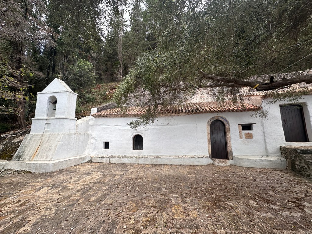
Walk up the quiet road through peaceful forest for 1.5km until you get to the semi-abandoned monastery (in the trees off to the left). It is very pretty and worth a short diversion to look around, or even a picnic (leave no litter, OC). If you pass on the 6th September the church will be open for services.
Agios Asomati Monastery
After looking at the monastery continue on the road, through vineyards, for 700m until an unsurfaced track goes off sharp left just after a bend to the right. Go down the track.
An unsurfaced track goes off sharp left after a bend right.
You now start to descend back towards Nidri, with the path zig zagging down the very steep slope. You get great views ahead.
The track zig zags down the steep slope back towards Nidri.
After 1km the track reaches a saddle below a low hill, where there is a junction with another track going sharp left. Take the track left. (If you go straight on you come to another track junction above Neochori – and back to Nidri by an alternate route – or on along the high-level track as far as Alatro).
This trail goes left and down. After going round a few more zig-zags you reach a section where a stream has gouged away a big section of the track. On foot it is possible to get past keeping to the left and climbing down.
The stream has gouged away the track, but still passable on foot.
Continue down the track keeping right, right then left until you reach the road where you started.
If you haven’t got a car or taxi arranged, it is 5km to Nidri downhill all the way along the road. If walking to Nidri it is less road-walking, and nicer, to take the Neochori alternative route.
Climb all* the Lefkada peaks over 1000m in one day. The route starts and ends in Eglouvi village with its traditional tavernas. To earn that beer and lentil soup you have to climb a total of 1,345m over 23.3km of rocky mountain paths. Are you up for this mega-challenge?
The route first takes you up Profitis Ilias, then a trek across the lentil plateau to a climb up Stavrotas, the highest peak. The route heads east to Mnimati peak. Then out to the south end of the ridge at Mourrat, back to the far eastern viewpoint at Katharia Rachi, finally descending to Eglouvi via the windmills.
Only do this trail if you are fit and have experience of mountain trails. There is no serious scrambling nor rock climbs, but it is long and over rough rocky paths. Take all the water you can carry – at least two litres each (and more if very hot). We strongly recommend using the GPX file on a GPS app or device to find your route.
* Note that “all” over 1,000m peaks does not include Mega Oros which is an off-limits military radar base. We go close but not fully to the top of Mnimati for the same reason. We don’t include smaller peaks, that are separated from a taller peak with a drop less than 30m. So it is “all significant over 1,000m peaks on Lefkada that you are able to climb without going to prison”. But that doesn’t fit easily on the T shirt.
Tavernas in Eglouvi. No accommodation but Karya is a 4km walk downhill.
Start from the Eglouvi village square. You can get water from the tavernas or from a tap under the plane tree.
Head off up the A3 path to the top of Profitis Ilias.
Walk a little downhill from the tavernas back towards Karya. On your left is a turning with a yellow A3 sign. Take this turning and follow the next yellow A3 signs left, right and right again through the footways of Eglouvi village. The last footway takes you back onto a road heading rightwards up the hill.
The start of the A3 trail in Eglouvi
At the top of the road (just as it turns a hairpin left) another yellow A3 sign points up a monopati heading up a steep valley. Follow up that monopati as it climbs right up to the top on the left side of the steep valley (almost a gorge).
The trail leaves the road just above Eglouvi heading up the steep valley / gorge
The going is pretty steep so take care. You follow yellow and red painted marks on the rocks all the way up.
Climb up the steep path
As you come to the top you start to enter a large quarry area. Keep going up the dry stream bed until you get to a trail junction with the A3 marked going off right. Go right and head over the quarry heading towards the mountain up on the right (your destination).
The junction of the A3 (going to Profitis Ilias) and M4 (going to Karya)
Head up the mountain ahead until you meet a short track heading from a road on your left. It is possible to take that road up to the top, but the A3 trail keeps right along the short track passing a small field. The track then turns back into a monopati climbing further up the mountain. Finally it reaches that road again further up. Walk a short way up the road to the church of Profitis Ilias at the top of the mountain.
The views from Profitas Ilias are equal to the best anywhere
Many describe this spot as being close to heaven. You can see all of the Inland Sea from here – on a clear day to the entrance of the Gulf of Corinth. When you’ve paused to take it in, set off back down the road. Keep going on the road as it passes around and across the quarry finally meeting another road at a T junction. Turn left along the road and then after 100m take a track going off right marked in red, yellow and blue paint.
For a while you follow the red, yellow and blue. The track turns left and then right onto a monopati across the low hills. You rejoin another track keeping straight on and then right. At a point the markers turn right onto another path, you keep straight on along the track until it rejoins the road. Go right and follow the road a short distance to the small church of Ag Donatos and its threshing floors.
Behind Ag Donatos church are several old stone shelters. This view looks back the way you have come.
Follow the road first right and then, shortly after, left heading to Ag Ilias. Follow the road up past twists and turns as it climbs up through the lentil fields. Just before the road turns sharp left on a hairpin at the end of a small valley a track goes off up to the right. Take that track. Keep left at two junctions and the zig-zag up the slope heading up towards Stavrotas. At the top keep right and over the low pass where the track fades for a short length as you cross the high meadow to the track on the other side. Head left up the track.
As you start to climb again the track is blocked and a path starts following the same route as the track but slightly down the hill. Take this path along and up to a small saddle of rocks. The red paint markers help you follow the trail. After the saddle you go left up to the start of the main slope up Stavrotas.
At this point a second path (which you will go down later after summiting Stavrotas) joins from the left with both yellow and red dots. Carry on upwards and slightly rightwards following red dots. Climb up the slight ridge on the left side of a small field system and up onto the steep rocks of the last part of the climb. Do not walk over the fields as they grow lentils even at this high remote spot.
Keep going up to the top. There is a slight false summit just before you get to the real summit. The real one is clearly the highest and has a small cairn, flag pole and shrine box. This is Lefkada’s highest point at 1,182m. The views from the top are in all directions. You can see up North over Preveza to Paxos and Corfu – South to Ithaca and Kefalonia – east to the Gulf of Corinth – west out over the Ionian Sea.
From Stavrotas looking south. The southern peak is lower and less than 30m of height separation. So not included in this trail.
After resting a while head back down the way you came to the path that came up from the left (now right). Head down that path. The way is not all that clear but you are heading down the right side of the small valley to the bottom where it passes a high goat hut. There is sometimes a dog chained up which you can avoid passing around either left or right to the track in front of the hut. Head right and down a short way until you reach a road.
Stavrotas showing path down, coming over ridge to right, passing a hut, and onto the track going left.
Turn left and head up a short way to the top. Another road heads off right heading to the communication masts on the top of Mnimati. Walk up this road, it is usually very quiet. Just before you get to the masts themselves a path crosses the road marked by red yellow paint. Follow the track off right as it descends a track past a small hut.
Follow the track off to the right before the antennas
Follow the track with red and yellow paint blobs as it winds down over the high plateau of Elati past several small hills. Ignore where the red and yellow paint marks go off left leaving the track on a path (you will go that way later). Soon the track stops on the ridge running north-south with a view down to Nidri. Climb up a faint monopati running along the ridge up to the peak of Mourat at 1,037m. This is the most southerly peak on this trail.
Your destination ahead on Mourrat peak
When ready head back the way you came to where the red yellow markers went left (now right). Follow the markers as they cross a field and then climb up to Katharia Rachi. This is the last peak at 1,085m with its stunning view down to Nidri and out over the Inland Sea.
Stunning panorama view from Katharia Rachi
Turn back almost the way you came but following the red yellow paint a little to the right heading directly back to the antenna masts on Mnimati. Follow up and down along the ridge passing the masts on the right-side and then descend towards Eglouvi. The ridge is fairly steep down so go carefully. Towards the bottom of the ridge the paint marks will take you around the right of a small vineyard and then down to a road. Head left a short way to a track heading up right.
Walk up the track to two windmills with their view out over central Lefkada and Eglouvi. Take the monopati down left behind the first windmill as it descends to the village. Follow the markers along the road to the centre of the village – straight on, right, left, right, left, right and up the steep path to the back of the tavernas.
Congratulations. You’ve completed the challenge. I strongly recommend the tavernas to refresh and celebrate. In fact you will often find me sitting there having lunch or an evening beer after a walk. I recommend trying the lentils – either as soup or salad. They are the best lentils in the world and a fitting meal for a champion hiker like you.
You can give a toast of thanks to the mountain runners of Eglouvi that maintain most of the monopatis you have walked. Theirs are the painted blobs indicating the various length runs. We are very grateful to them for keeping these paths open.
A short trail over the headland between Ag Nikitias and Mylos Beach. Mylos is one of the best beaches on the island. Ag Nikitas, too, is a pretty seaside village on the north west coast of Lefkada; with a nice beach and tavernas. A pleasant place to spend time. However 30 minutes walk takes you to a much larger and quieter beach. On the headland is an old windmill – hence Mylos Beach (the English word “mill” comes from the Greek word “Mylos”). The beach is almost all wonderful sand.
The walk is short, but up and down steep steps. So best to do it in the morning or evening in summer, or anytime the rest of the year. There are no tavernas or anything else at the beach, although a caravan serves drinks in peak season. So best to take what you need – and, of course, bring back all your rubbish.
Note that this is the only public-access trail to Mylos Beach. Two other tracks down to the beach are private and blocked with locked gates. The cliffs make any other potential route highly dangerous. On calm days in summer boats will take you to the beach from Ag Nikitas.
Tavernas and accommodation in Ag Nikitas. A seasonal kiosk at the beach.
Park on the road on the edge of Ag Nikitas. The village itself is car-free apart from residents. There is quite a bit of space for parking on the road but, as Ag Nikitas is popular, fills up fast in summer. You can also park towards Lefkada town and walk into Ag Nikitas along the coast.
Sign in Ag Nikitas at the start of this trail
Half way down the pedestrian road from the nearest parking to the beach is a sign to Mylos Beach pointing left (if facing the beach). Take this path as it goes up and slightly left up steep steps. Climb up to the top with good views back into the village.
The path runs over the headland, some parts paved, other parts rough.
The path runs up and over the headland through a forest giving some welcome shade. It then starts to drop down the other side. Here you get your first glimpse of Mylos Beach ahead. The path now starts to descend down very steep steps. Take great care.
View down to Mylos Beach
At the bottom is the beach. You can walk along the wonderful sand to the headland at the far side. You can also walk on the dunes behind the beach – but please stick to the paths and don’t walk on the flowers, herbs and grass that bind the sand.
The old windmill up on the headland from which the beach gets its name.
Mylos Beach is a great place to sit, swim, picnic, smooch, whatever. A common question Lefkadians get asked is “what is the best beach”, with so many to choose from. A common answer is to avoid giving away that really nice quiet one. Mylos could be that beach.
Return back the way you came. Two other paths down are private. Don’t even think of climbing the cliffs at either end of the beach. On calm days in summer it is possible to get a boat back to Ag Nikitas. Note that the summer daily wind pattern is for a north westerly blow mid-late afternoon (it is why sailing and windsurfing is so good here). Be prepared to walk back.
The Trail of the Three Monopati. Climb up Skaros mountain from the Red Church above Nidri. This routes forms a loop following three classic monopatis. Combined with the views from the top of Skaros it is one of the best medium length trails of eastern Lefkada.
You need a car or taxi to get to the start of the route at the Red Church.
Taverna in Kolyvata.
Make sure you take plenty of water. The trail is reasonably long and challenging. The trail is marked with red-orange markers along most of the route. At times you have to watch for them carefully. Don’t confuse with red lichen rings that can be similar. However, as always, we recommend you follow the GPX trail on your mobile phone.
The trail starts at the Red Church or Monastery of Evangelistria just off the road up from Nidri towards Platistoma and Karya. Park in plenty of space in front of the monastery. With your back to the monastery head left across the lawn to a track starting to climb up through the trees. You soon pick up the trail of orange/red blobs that take you to the top of Skaros.
The lawn in front of the monastery where this trail starts.
After climbing for 500m as the track forks right and then left you soon come to a monopati heading right just before the track curves left.
A monopati heads off right as the track curves left
This monopati was recently cleared and restored by the Nikiana mountain runners and it is a beauty. It climbs up along a wall with wonderful shade from the overhanging trees. It crosses a small ravine and then traverses up and across through the trees. Eventually you meet a track where you turn left up the slope. Climb up the track. After 500m the view starts to open out on the right down to Nidri and the Inland Sea.
After 500m views open up on the right down to Nidri.
After almost a further 1km a path goes off right where the track hairpins left beside a wood electricity pole. Take the path up the steep slope up to near the top. Follow the path to the top near the telephone antenna.
Amazing views down to the Inland Sea and the mainland beyond.
Take a while looking at the wonderful view down the east coast of Lefkada. Stand where Odysseus did. When you are ready, head back down the track behind the masts. After a short distance the trail of orange/red blobs goes off right down a path – do not follow them, rather keep on the track. It joins another track at a T junction where you go right. Follow the wonderful track as it threads between the Skaros peaks and huge oak trees.
The track descends down a concreted section to a high meadow with metal goat huts and tracks heading off right. Ignore the turnings and keep straight on. The track climbs a little until you reach a large orange/red arrow pointing up a path heading into the trees up left.
A big red arrow shows the monopati going left in a corner of the track
Take that path and start to follow the orange/red blobs again. The path climbs up and passes over a ridge before dropping down and right down the far side of the hill.
The monopati descends though the Skaros forest
The track descends for 1.5km down a long stone ledge for much of the way. This is the second classic monopati on this route. You get great views ahead of you down to Kolyvata, Alexandros and over to Karya, with Profitas Ilias mountain behind. Eventually you pass a tiny monastery on your left and reach a road. Cross the road and continue on the path on the other side. After 300m you reach a track where you go right down towards a church and then take the track running down the left of the church. Keep straight on down heading into the houses of Kolyvata. The track runs down some stone steps going right and then turns left between two houses down to a road.
The path comes out onto the road between Maria’s taverna and a house.
The house on the right is Maria’s Taverna. If open this is a good place to stop for refreshment. If you want food you normally have to phone ahead and book. Maria runs the taverna by herself. If you do eat, the food is delicious.
Turn left along the road, past the small parking area, and down the path heading down a ramp straight ahead.
The trail leaves Kollyvata along a slowly descending path
Keep going down and the path soon starts to descend quite steeply into a small ravine. Keep an eye out for the orange/red markers and you won’t get lost. At the bottom you cross the stream and start to climb up more gently though the wonderful pine forest. The path becomes a track.
The track turns left twice and starts to head down the left side of a deepening gorge. At a fork turn right and start to descend again. After a while the path narrows. After 200m turn off left into the trees. Watch the red markers. Be careful as I’ve found the markers switched around (joke?). The arrow should point left and the cross should be on straight ahead.
The turn left to enter the tree lined path
The trail enters a delightful wooded section with the path threading around and under the thickening trees. The third classic monopati runs through the trees with the trees forming a tunnel over the path. An amazing path.
After a descent a similar path joins from the right. Go left and exit the forest. Cross a track and follow the path through to the open area where the Red Church is on your left.
A big shoutout to the Nikiana based Lefkas Trail Run> who cleared all three of these wonderful monopati. Their work keeping Skaros trails open has been consistent over the years. We wouldn’t be able to do this website without them.