Climb up the highest peak on Lefkada up the shortest route. Stavrotas is without doubt Lefkada’s top mountain: it is the highest at 1182m, it is unencumbered with man made masts or buildings, it has impressive steep crags and screes, and has far reaching views in all directions. If you like mountains and come to Lefkada you must climb Stavrotas. If you can pick a day with clear blue skies and no mist or haze.
There is an alternate longer but less steep route: Stavrotas from road above Eglouvi. You can use one to go up and one to descend as it isn’t far along a quiet road between the two trailheads.

This route starts from 960m leaving a mere 222m to climb over just over one kilometre. What a reward for such a small effort. However it is not to be taken lightly as the climb is up over steep rocks. The weather can change quickly at these heights with mists and high winds. In the summer the sun is strong and there is no water. Be prepared.
You need a car or taxi to drive up to the starting point.
Tavernas and accommodation in Agios Ilias.
Links to trails down to Eglouvi and Agios Ilias
The trail starts from the very top of the road up from Agios Ilias heading towards Eglouvi. As the road reaches the top it goes around one last bend and a track heads off uphill to the left. Park anywhere near here and take the track.
The track heads into a small high valley with fields and pasture. Very shortly you reach a small hut on the left where the track divides. Take the left track running past the hut on the left hand side. There is often a dog attached to a chain blocking the track – but this is easily avoided with a path that run around to the left and then re-joins the track.
The track turns suddenly to the left and heads straight up the steep slope – at this point carry on straight ahead on the path that goes off right.
The trail is marked in yellow and/or red dots and steadily climbs up the slope going diagonally to the right. It is unclear in parts so a GPS map helps. After a climb the path goes over a small ridge with large upstanding rocks.
At this point a second path joins from the right marked with red dots (Stavrotas from road above Eglouvi). Carry on upwards and slightly rightwards following the red dots. Climb up the slight ridge on the left side of a small field system and up onto the steep rocks of the last part of the climb. Do not walk over the fields as they grow lentils even at this high remote spot.
Keep going up to the top. There is a slight false summit just before you get to the real summit. The real one is clearly the highest and has a small cairn, flag pole and shrine box.
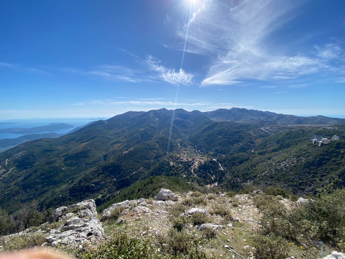
The views from the top are the best in Lefkada. You can see up North over Preveza to Paxos and Corfu – South to Ithaca and Kefalonia – east to the Gulf of Corinth – west out over the Ionian Sea.

It is possible to walk along the ridge to the southern peak of Stavrotas. The going is rocky but you can pick a path that is no harder than the climb to the main peak.

Retrace your steps back down the path. Alternatively follow the trail Stavrotas from road above Eglouvi in reverse and then walk back along the quiet paved road to your starting point.