This walk runs between the mountain villages of Eglouvi and Ag Ilias. It climbs up and over Mount Elati visiting the high peaks of Katharia Rachi and Stavrotas before descending to Ag. Ilias. This takes you over the highest part of Lefkada; crossing from the north to the south of the island. The trail is along monopati and unsurfaced tracks for almost all the first half of the route – with a quiet road descent on the other side.
The trail is the fourth part of the Lefkada Trail. It is one of the hardest days as it climbs high and is long too. The full route takes you over both Katharia Rachi and Stavrotas. Katharia Rachi is the end of a ridge and has the best view in Lefkada. Stavrotas is the highest peak on Lefkada. If the day is too long for you then you can easily skip one or the other of these. But do come back when you have finished the Lefkada Trail and do what you missed on this day. Otherwise, you don’t get the T-shirt 🙂
Start in Eglouvi in the main square with the tavernas. If you haven’t got water fill up now – there will be no more drinking water until you get back down. There is a tap next to the plane tree or buy from the tavernas.
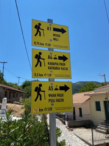
Go up and round to the left of the tavernas and down the narrow path to the right. You will soon see the sign for the start of three trails. You follow A4, and A1 will accompany you as far as the windmills. You follow red and yellow paint markers and A4 signs all the way to Katharia Rachi for the first part of this trail. They are pretty clear for most of the way.
Walk through the quiet village roads until you see a monopati heading up to the left up the hill. Follow this diagonally up until you reach the windmills.
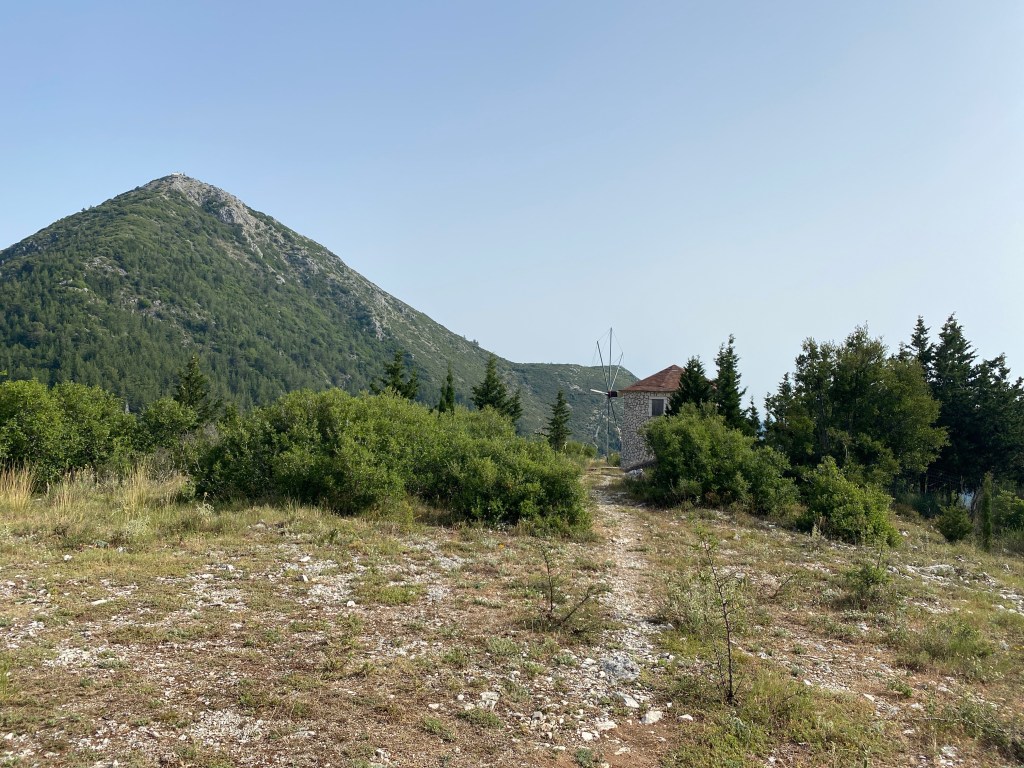
After exploring those and enjoying the view take the track up to the right behind the windmills. Follow to a surfaced road. Turn left and follow around a few bends until there is an unsurfaced track going off right. The track has a read and yellow arrow painted on the road pointing where you need to go. Beware there is a second track a few hundred metres later also with a red and yellow arrow. Make sure you take the first.

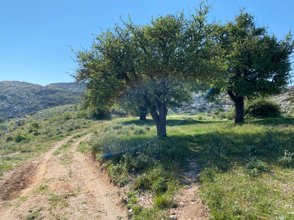
The track approaches a vineyard where a monopati branches off left. It skirts around the vineyard and starts to climb the ridge. The monopati now goes up the crest of the ridge to its top. This is a steep climb but you get fantastic views all the way up – a real classic. There isn’t much shade but it is well worth the effort.
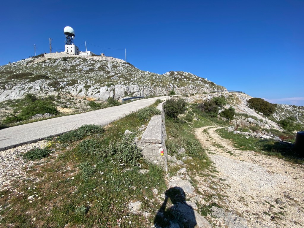
At the top of the ridge the monopati becomes a narrow track going past a very small lentil field (make sure you go round not over). The track turns right to head up to the radio masts on the top of Mnimati, but the A4 monopati actually goes straight on and slightly downwards. Make sure you don’t miss the monopati painted dots.
The monopati is now much easier following down to a small pass and then gently up the ridge to the top of the peak. Finally you get to the sign indicating the end of the A4 on Katharia Rachi.
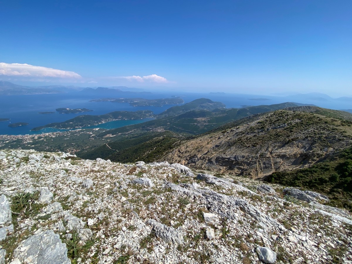
Below you is a wonderful view down to Nidri – with all of the Inland Sea and islands behind. If you have eaten at one of the tavernas at Geni and looked up – this is the steep crag fringed peak you will have seen above you. A fantastic place to sit and enjoy the view. Stand where Odysseus did.

When you have finished looking take the path heading sharp-right almost back the way you came. The same red and yellow paint marks descend down and right down to high pass below you. After about 200m the marked path turns back left and descends more gently to the pass. The path then turns right and goes over a low hill until it reaches a T junction with an unsurfaced track. Follow the painted marks off right.
Follow the track as it winds across the high plateau. There may be wire fences to cross but most have tied “gates” where crossing the track. Leave them as you found them as they stop the cows roaming.
The track eventually climbs back up to the road near the radio antenna at the top of Mnimati. At this point leave the paint-marked trail and take the road going left away from the masts.
Descend the road for 1.5km until you reach a junction. Take the road left going down towards Ag. Ilias. After a few bends there is a track off up to the right. Here you have a choice whether to climb Stavrotas up above you or to carry on down the road to Ag Ilias. The route up Stavrotas from here is 1km long and 220m of climbing – and then back on the same route. If you do climb Stavrotas, and being Lefkada’s highest mountain you really should if able, you will eventually return to this point on the road.
The track heads into a small high valley with fields and pasture. Very shortly you reach a small hut on the left where the track divides. Take the left track running past the hut on the left hand side. There is often a dog attached to a chain blocking the track – but this is easily avoided with a path that run around to the left and then re-joins the track.

The track turns suddenly to the left and heads straight up the steep slope – at this point carry on straight ahead on the path that goes off right.
The trail is marked in both red and yellow dots and steadily climbs up the slope going diagonally to the right. It is unclear in parts so a GPS map helps. Goats don’t have GPS and make several tracks – but keep going to the ridge up and right. After a climb the path goes over a small ridge marked by two large yellow painted arrows on the rocks.
At this point a second path joins from the right marked with red dots (Stavrotas from road above Eglouvi). Carry on upwards and slightly rightwards following the red dots. Climb up the slight ridge on the left side of a small field system and up onto the steep rocks of the last part of the climb. Do not walk over the fields as they grow lentils even at this high remote spot.
Keep going up to the top. There is a slight false summit just before you get to the real summit. The real one is clearly the highest and has a small cairn, flag pole and shrine box.
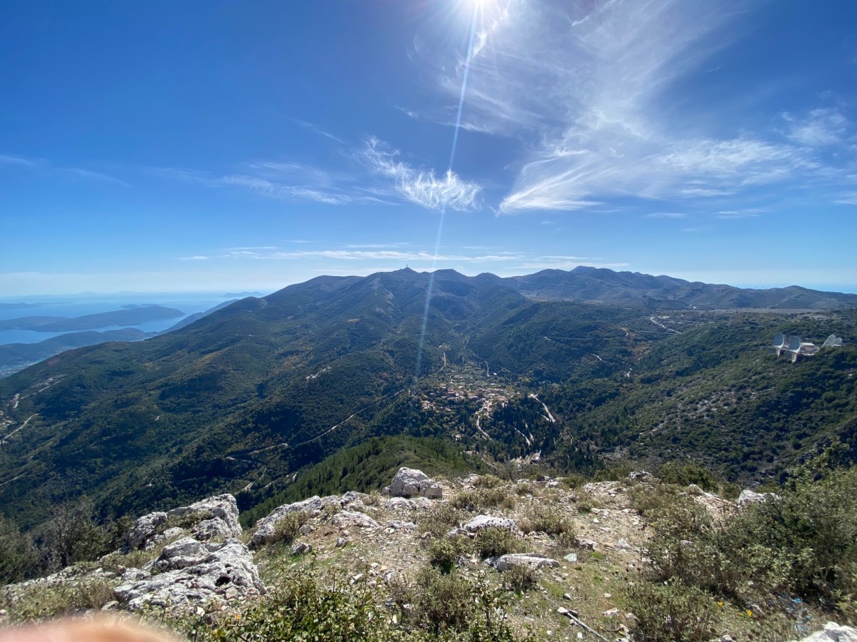
The views from the top are the best in Lefkada. You can see up North over Preveza to Paxos and Corfu – South to Ithaca and Kefalonia – east to the Gulf of Corinth – west out over the Ionian Sea.

Retrace your steps back down the path until you reach the road where you started up Stavrotas.
Descend down the road about 3km into Ag. Ilias village. If you use your map, there are a couple of paths down this slope as alternates to the road, but very rough and overgrown and indistinct lower down, so hard to recommend (use your discretion and scrambling ability).
The road passes a monastery and bell-tower viewpoint. Near the village the road becomes a one-way system (the roads being super narrow in the village). Best to follow the right hand side where cars also descend. Just as the road recombines there is a very welcome taverna.
Well done, you have just done the hardest day. Take a well earned rest and consider day 5 tomorrow – being much shorter and much less climbing. There is limited accommodation in Ag Ilias. There is much more accommodation and tavernas in Syvros a few km further down the road (walk taking a very good path running to the left of the winding road). Or arrange a taxi or lift back to your base. Day 5 will start back in Ag. Ilias – or in Sivros if you walk down to overnight there.