

This walk runs from the small harbour of Nikiana to the mountain village of Karya. It climbs up and over Skaros mountain, past Alexandros, and across the Livadi polje (see below) to the mountain village of Karya. The trail is along monopati and unsurfaced tracks for almost all the route. You also get some fantastic views and walk through hidden wildlife paradises. This is probably one of the most varied trails on this website; it takes you from sea to mountains.
This works well as a day walk, get a bus/taxi to Nikiana and then back same from Karya. Or walk just part of the trail; Alexandros to Karya being good as a short gentle route.
The trail is the second day of the Lefkada Trail. It is a steep climb up Skaros mountain – then easy tracks across to Karya via Kollyvata and Alexandros.
The trail starts in Nikiana. Follow the signs to the Crystal Waters hotel and go to the uphill side of the hotel. From there a surfaced but narrow and rough road climbs straight up the hill. Go round four hairpin bends climbing out the village and heading up the road through olive groves. In the middle of a straight section a track forks off slightly downhill on the left. The track is surfaced in concrete for the first 10m and marked by a painted orange arrow.

After a few hundred metres the track forks. Keep right climbing gradually up the hillside (ignoring two villa driveways).

After a few hundred metres more a monopati fork right off the track. Follow this path sloping up the hill.

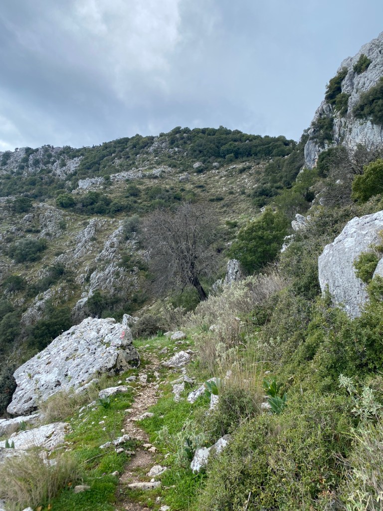
The monopati turn right and starts to climb up the right hand side of a stream-bed zig zagging up the hill. The trail is marked with orange and red painted markers from here to the top. The way is very clear but don’t mistake red lichen for paint.

After a climb up the right side of the stream-bed the monopati turns right to traverse up along stone ledges heading up to the steep crags above. The monopati zig zags up again before heading back left across the base of a tall crag with a small cave just above the path. The monopati zig zags up through a gully taking a clever and safe route up to the top.
All the way up there are wonderful views across the Inland Sea. You can see north up to Lefkada town, Preveza and beyond. Directly east are the mountains of the mainland. South you can see down to Scorpios and Meganisi. Take time to savour these views. Also give a cheer for those that made this classic monopati in times gone by.

As you come over the top you enter the oak forests of Skaros. Many of these trees are hundreds of years old – although many remain relatively small. These oaks are unique to Skaros.
The path heads up a small valley and over a pass to a short descent down to the sheep and goat huts of the Skaros high pastures. To the right is the track we will follow.

The track right starts from a boulder with an orange “23” and arrow pointing along the track. This refers to the route of the 23km mountain run held every autumn. Follow right along the track for about 200m. At a bend in the track a big red arrow points to a monopati heading up right through the trees. Take that monopati and follow the red marks up a small wooded valley to the top where there are several very large ancient oaks.
Keep following the red marks as you go over the hill joining other paths coming in from the left. Keep right and start to traverse and gradually descend on the other side of the hill. The red marks get less frequent as the path becomes clearer.

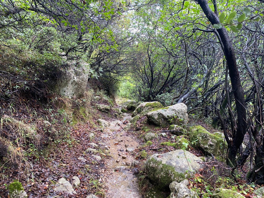
The trail now follows a classic monopati that traverses across and down the Skaros peaks. The path is very clear and at times you walk over a gently descending stone ledge – a marble walkway. This is possibly one of the best examples of the monopati network that once covered all of the island.
After 3km you pass St George’s monastery (founded in 1500s) to your left and reach a road. Go straight over the road and continue on a second monopati. This monopati runs a short distance down to a second road. Go right down to a car park behind a church and take the footpath running down the left of the church – following a dry stream bed (maybe wet if it has rained recently). At a path junction go left and down a short path beside Maria’s taverna to the road in the centre of Kolyvata.

Stop for refreshment if the taverna is open. Maria prefers for you to phone ahead if you want food, but she can usually give you a drink unless closed. Opening hours are irregular unless you have booked.
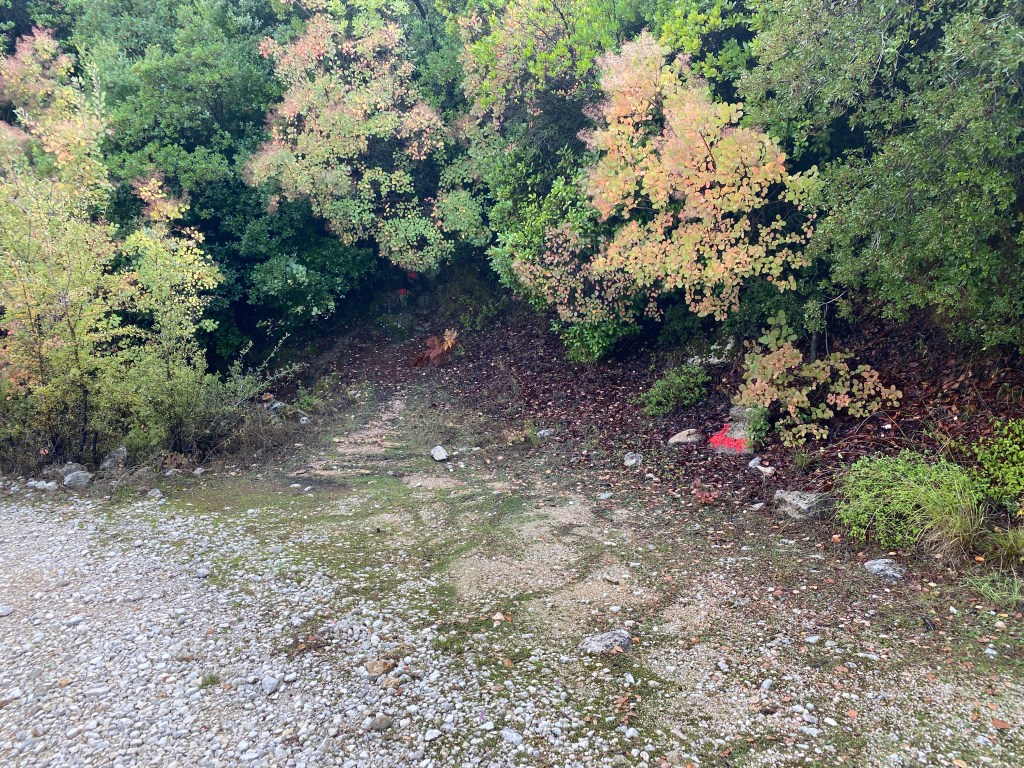
Turn right along the road out of Kolyvata. At the first junction keep left and go 500m across to Alexandros village. As you enter the village there is a junction with an old school on the left and a concrete watertank on the right. Take the turn right, passing between two old windmill towers and descending into a small valley. Just before you get to the bridge over the stream (likely dry) a track goes sharp left down a concrete ramp into the thick forest. Take that track.

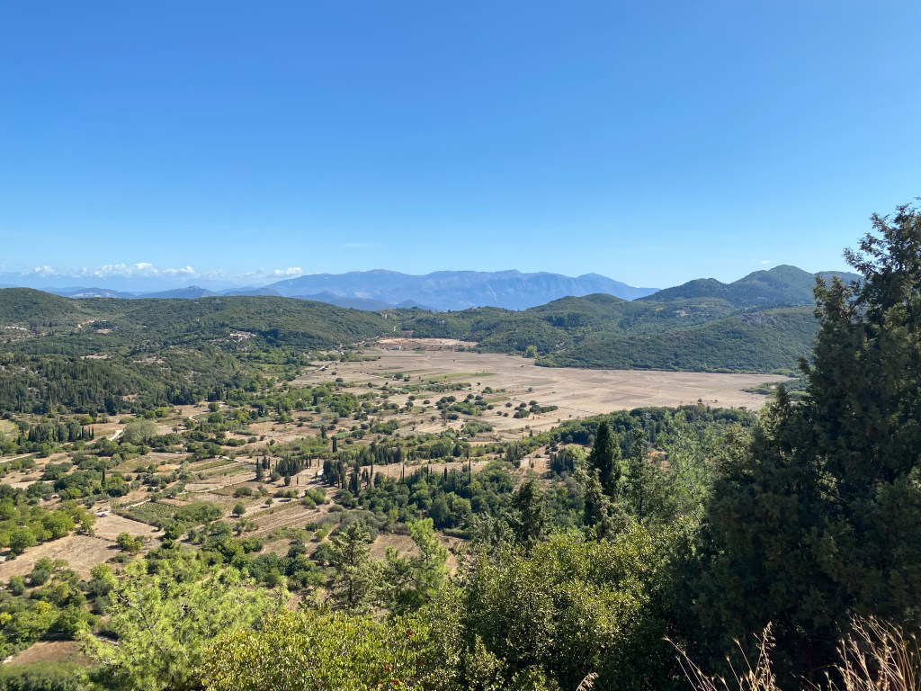
The track descends down a valley to the Livadi plain (or polje). A polje is an area that has no visible outlets for streams, except through the limestone surface. Indeed Livadi is usually flooded in winter. Most paths are on causeway and passable but be prepared for short detours if rains have been very heavy recently. It is a magical place when flooded with lots of wildlife so possibly the best time for this walk. Karya village, your destination, is on the hill on the other side of Livadi.
Keep right on the track as it descends to the bottom of the polje. The track turns to the right and passes some tall trees. Here is divides. If you go left the path runs straight across the polje, crossing one road before reaching a second. If it isn’t flooded go that way. If that way is flooded, instead go straight on along the base of an earth dam (to your right) directly to the road. Take the road left crossing directly towards Karya.

As you reach the far side of the polje keep going straight on on the road past some farm sheds and climb the steep wooded slopes up to Karya. The road zigzags up joining another road coming up from the left. A little way after a hairpin left a road turns off right going up. Take that road and keep straight on, through Karya village, past a school, until you get to the village square.

Karya square is a delightful place to rest. There are several tavernas, cafes and shops around the square shaded by large plane trees. Accommodation is available in the village and a bus connects back to Lefkada town.
If you are on the Lefkada Trail day 3 starts tomorrow from Karya square.
I went wrong from the outset and ended up walking on the road to Kollyvata where I picked up the path from St. Georges Monastery. I then continued on the road towards Karya. Showing your book at Maria’s taverna did not seem to produce the desired effect so I went off with my tail between my head.
Richard 9walked three times in early Sept 25