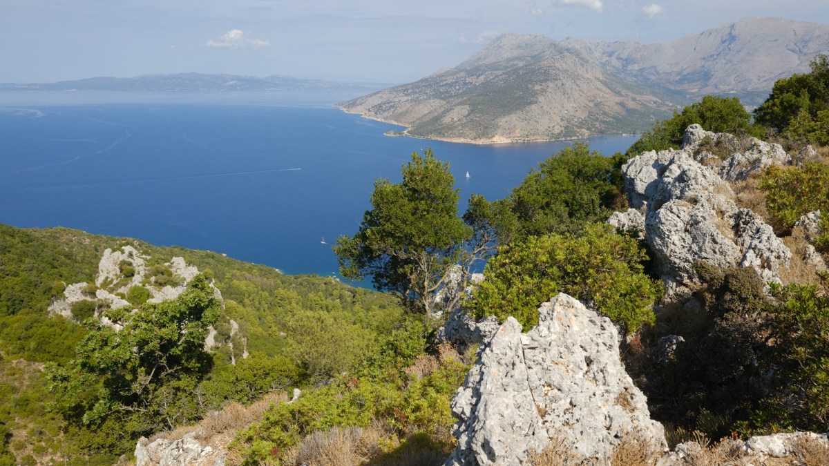
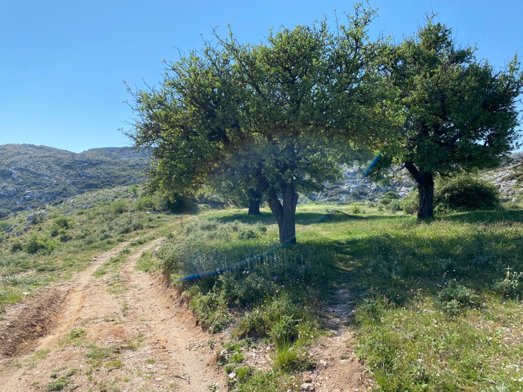
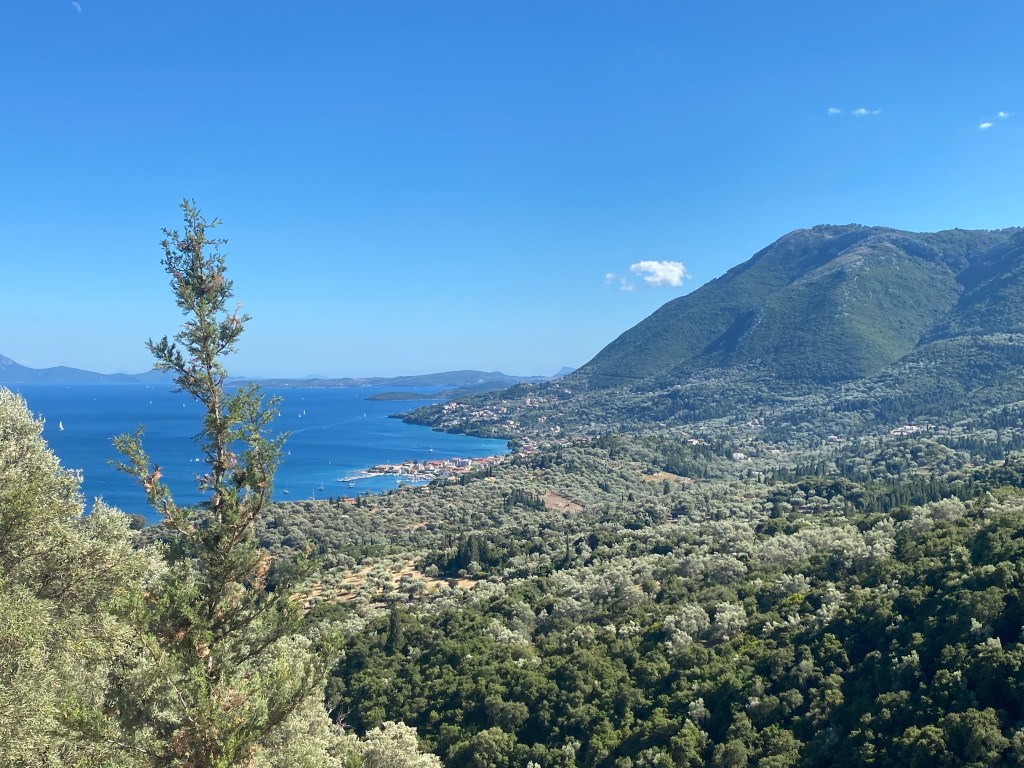
A hike on the small island of Kalamos, east of Lefkada and close to the mainland. The trail ascends to the tiny church of Agia Paraskevi high on a pass between the two main mountains of the island. There are breath-taking views from the top.
Ferries to Kalamos from Lefkada Town or from Mytikas on the mainland. It is possible to hire a boat for you or a skipper to cross from Mytikas.
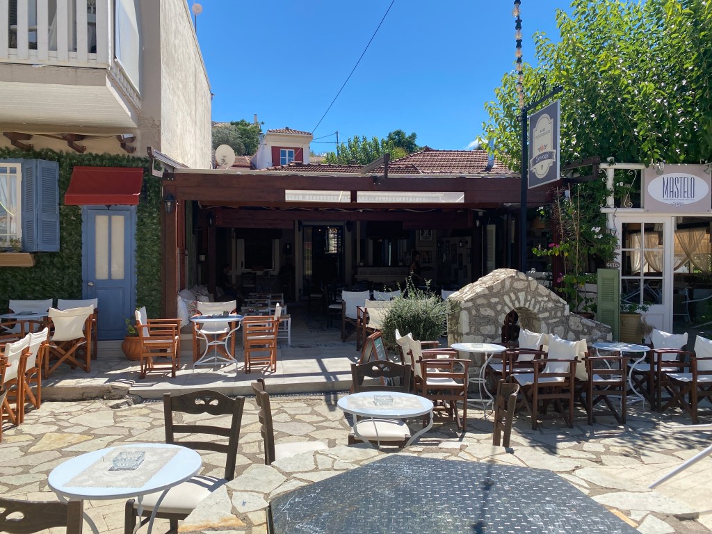
Accommodation and tavernas on Kalamos.
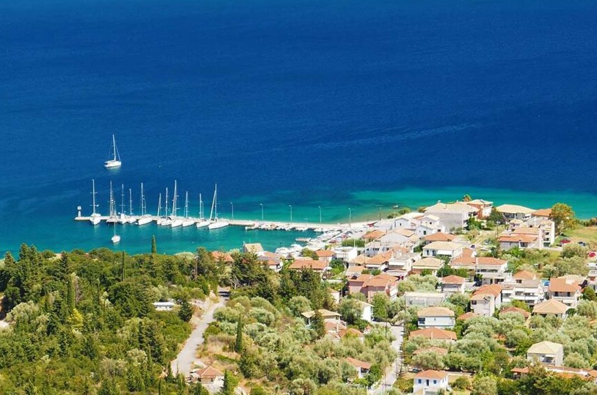
The hike starts from Kalamos main port on the south-east side of the island. The port is usually busy with visiting yachts and flotillas vying for space to moor for the night. There are shops to stock up with water and cheese pies for your hike.
Set off up the road leading up into the town from the port. After 30m turn left up a steep path.
The steep path leading up from the port.
After two bends fork right, and then take the first narrow road going right. After a short distance you join another road where the route straight on is marked “no through way” – a path goes left straight up the hill between two houses. After the houses go right along the road.
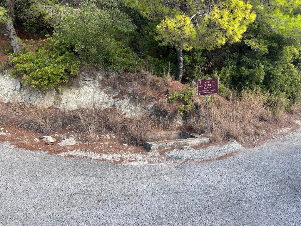
The first turning left up to Ag Georgios church.
The road heads along to coast slowly climbing. After 800m there is a road going sharp left back up the hill signposted to Ag Georgios church – take that road. After 400m a track goes sharp right also signposted to the church. After 300m you pass the church keeping to the right onto the track as it starts to ascend the mountain.
Looking back down towards the port.
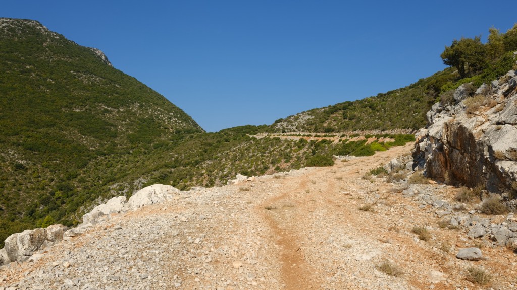
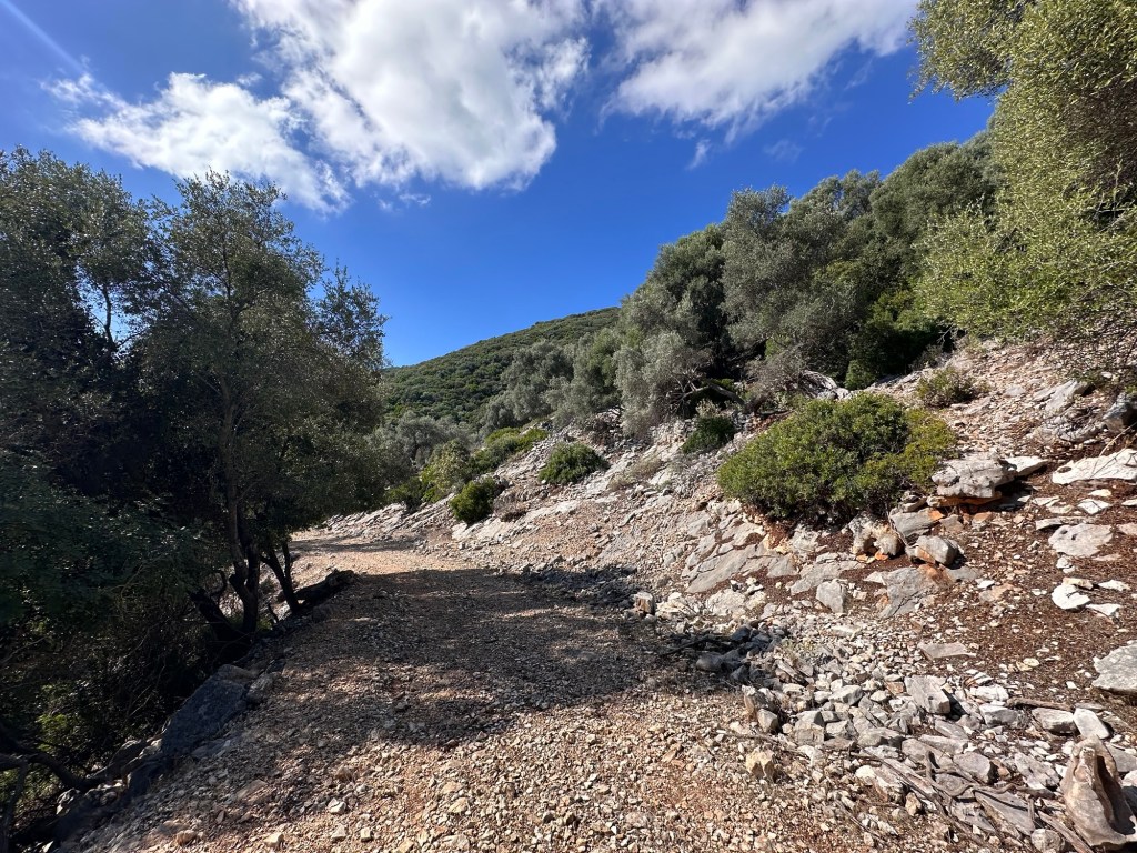
You now climb up through olive groves then pine forest getting higher and higher. The track turns to the right and then left as it zig-zags up the hill. You are heading for the top of the pass between the mountains up ahead.
The track climbs up to the pass.
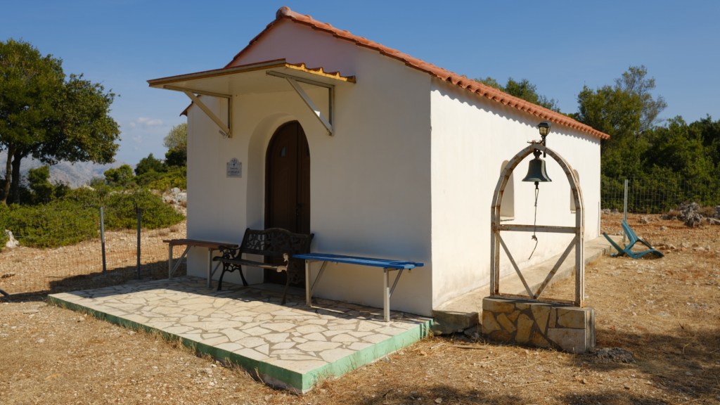
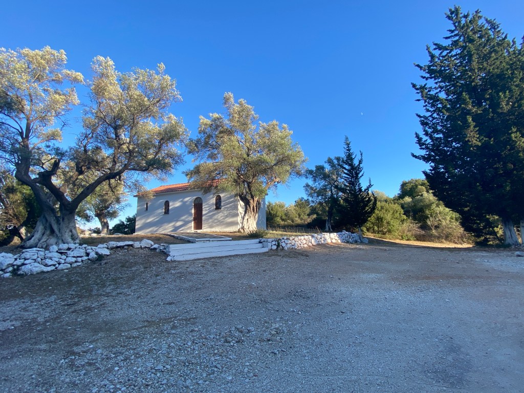
At the top the track goes a short way to the right where is the tiny church of Panagia Agia Paraskevi. There are a few benches outside and it is a very pretty spot to sit and eat those cheese pies. You get views in both directions to the south and north.
Tiny church of Agia Paraskevi
The church is of St Friday, an early Christian martyr. A wonderful spot. When you have rested retrace your steps back down to the port.
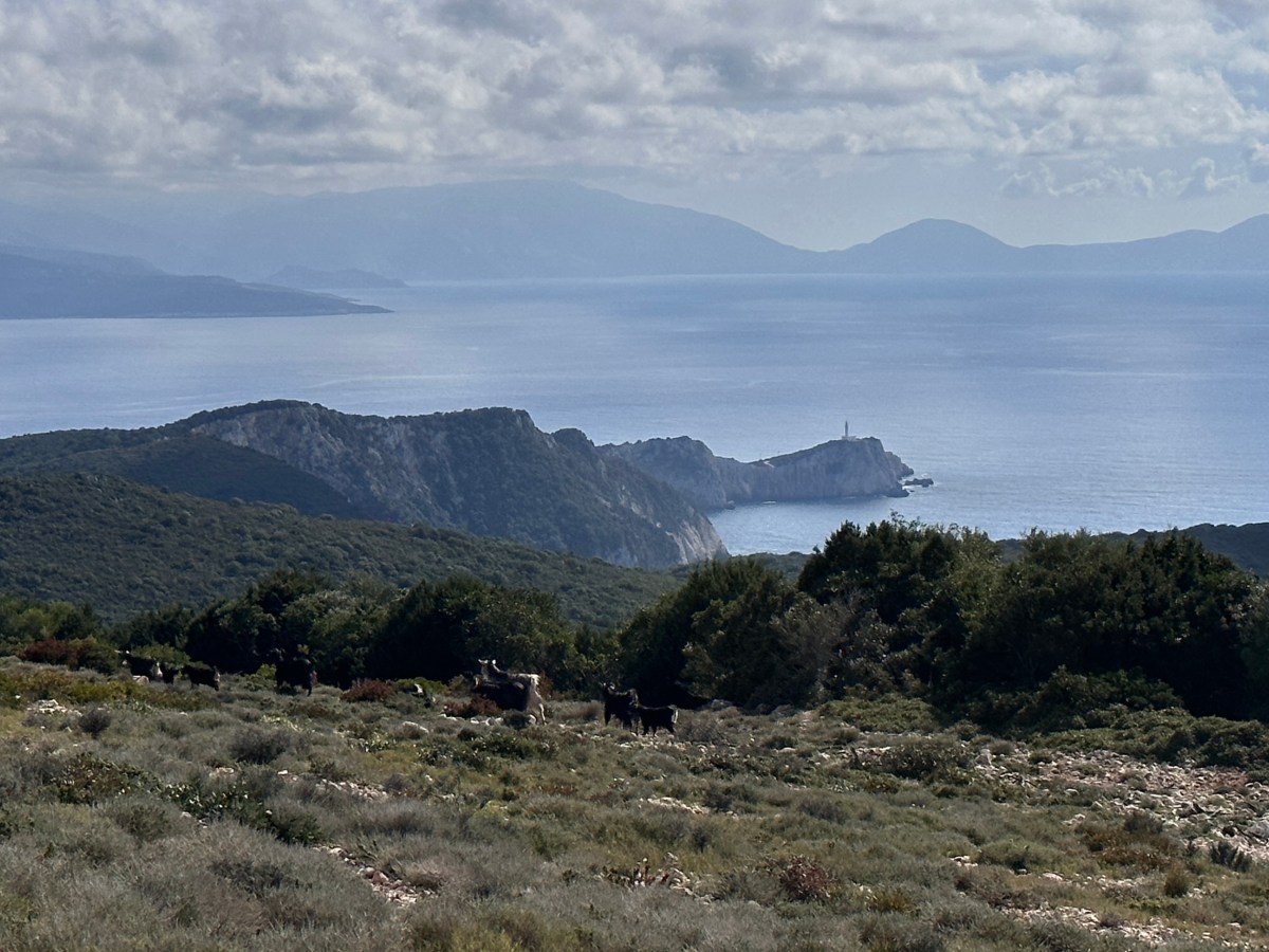
On the map are two other marked paths, one ascending the mountain to the right, and the other descending the pass on the other side. Both of these paths are very hard to follow on the ground, and cross extremely rough ground with thick vegetation. We cannot recommend either, unfortunately, after having tried them both. The path down was blocked by discarded cuttings when electric workers repaired the transmission lines. We will update this website if the path is repaired.
Get the best of two worlds with this loop around a mountain on Meganisi island, starting high level with sweeping views, then back along the coast with coves and beaches. Starts and ends at the port where ferries arrive from Lefkada. Get a morning ferry over, do this walk, and take the late afternoon ferry back to Lefkada. Make sure you leave time for a swim and a fish supper, whilst waiting for the ferry back.
The walk is quite long but along easy tracks and then a road. As always take lots of water. Also your swimming clothes and a towel. It is possible to shorten the walk back, bypassing the walk along the coast. The trail is suitable for a mountain bike, and bikes can be rented in Nidri and Spartochori.
Take the ferry across to Meganisi from Nidri. It runs a few times a day with enough time between morning and later afternoon crossings to do this hike.
Tavernas in Spilia, the Meganisi ferry port. Accommodation and tavernas in Spartochori.
The route starts from Spilia port on Meganisi island where the ferry docks from Lefkada. The ferry runs from Nidri, most of the year three to five times a day – usually with morning and late afternoon ferries. It takes just 20 minutes and is very cheap for foot passengers. Just walk on and pay on board, no need to book. > Check online for the timetables that change every month. There are tavernas in both ports so easy if you have time to kill.
When you come off the ferry, head left on the road as it runs around the bay and starts to climb. After 300m there are some steps on the right that takes a shortcut across the zig-zags of the road. There are then another set of steps doing the same further up. You end up, either by road or steps, in a little square in the village of Spartochori, with great views back to Lefkada.
The village square in Spartochori.
Take the road going up from the square, take the first fork right, then the second left until you reach the main road running through Spartochori with a few shops. Go left along the main road to a T junction where you go left then immediately right. Keep going straight on to a fork by a builders yard where you go right on the smaller road.
Fork right by the builders yard.
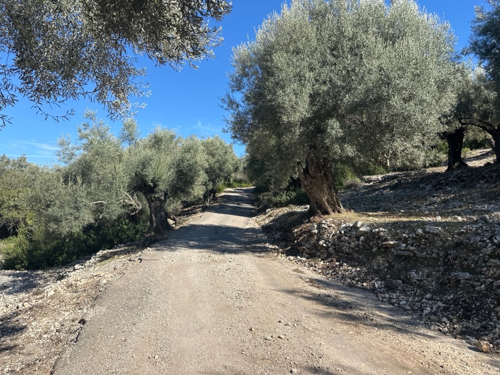
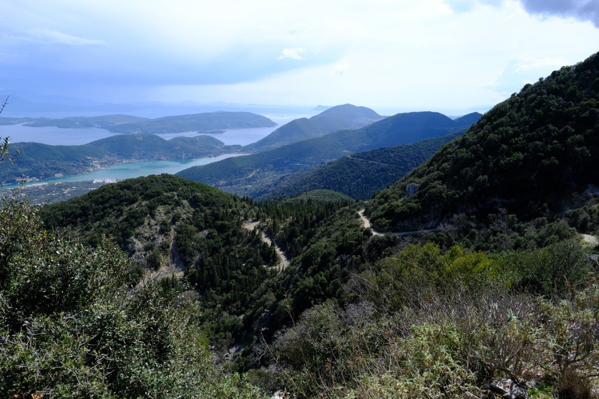
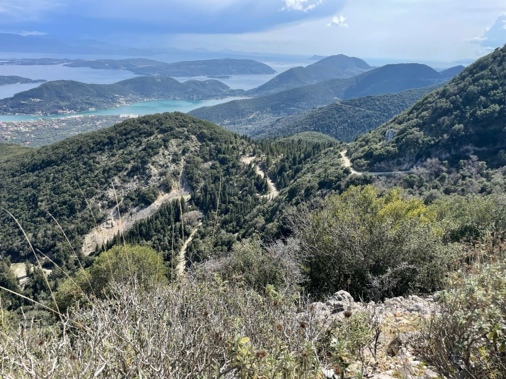
Keep going straight on and forking right, and the small road becomes a track, leaving Spartochori behind. The track runs for 3km down the eastern side of Meganisi, high up on the hill. You climb up further and both the track and the views get better and better. You run through ancient olive groves within water shaped limestone rocks. You get views first north over the mainland, then south east towards the Corinth Gulf, then south down the long tail of Meganisi. This part of the walk is stunning. Part way there is a metal gate across the road. It is easy to untie the rope and open – make sure you close and retie, it keeps animals in.
The track gets better and better.
Shortly after passing the southmost point you pass the track that runs down the long tail of the island. This trail does not go that way as it is only there and back and about 7km each way. Feel free to divert if you are uber fit, otherwise continue on the track as it turns back north.
The start of the track down the long tail of Meganisi. We don’t go that way today, but you should be safe if you walk. It is a dead-end so allow time if you do venture down.
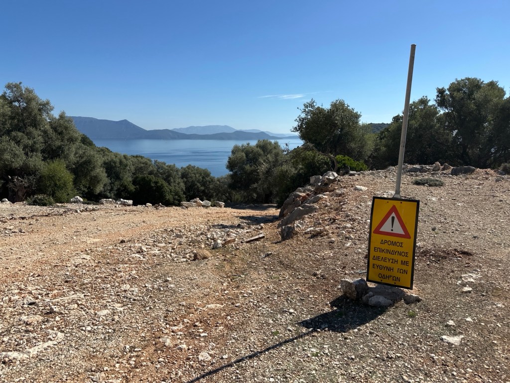
On the west side of the island you run into increasing signs of villa building projects. Unfortunately, this rather detracts from the ambience for a short section. After 1km you get to a fork where the road going left is new tarmac and the right track climbs up. We are going to go left to get down to the coast road, but the right fork is a track going straight back to Spartochori making a shortcut back to the ferry.
Walk left along the new road for 1.3km until you get to a road junction. Go left down the hill (if you go right it is a second shortcut to Spartochori along a road). After a few zig-zags down you reach the sea near a pretty church, a coffee bar and a pebbly beach. When you are ready take the road going right along the coast.
Walking back along the coast road with many great swimming spots.
You follow this coast road now right back to the ferry, 4km. It passes a series of beaches, big and small, as well as beach bars and small tavernas. They are only open in season, but very nice if so. If you walk out of season then it will be quieter but you need to take your own picnic and drink. Take your pick of wonderful places to swim in the clear waters.
After about 3km you get to the headland just before the ferry port. The road heads inland a little, though with nice trees for shade. There are three short climbs, the last one being the longest (don’t worry you are nearly there). At the top of the last hill the road forks – go left and back down and around to the ferry. If you go right it takes you to Spartochori.
The road at the first of three short climbs.
In the bay just past the ferry terminal are several tavernas – all good. A great place to wait for the next ferry. Also a great beach where you can swim safely (marked so boats can’t run you down). Don’t swim where the boats sail or dock.
A hike from the Vasiliki beach town along tracks up into the olive trees and pine forests along the valley leading up to Mount Elati. The halfway point is the almost abandoned village of Roupakias with its pretty church and a rock ravine cut by the river. The trail then heads back to Vasiliki along quiet roads in the base of the valley.
The route is pretty easy along tracks and quiet roads with some gentle hills. It would make a good mountain bike route too. There is quite a lot of shade but, as usual, carry plenty of water. There are quite a few turnings on the trail so we advise, as always, to download the GPX file into your phone app, so you can easily follow along. Route “R” signs mark all but the last section of the trail.
Frequent bus to Vasiliki from Lefkada Town. Walk from Vasiliki to the start of the trail – or park your car at the start.
Plenty of tavernas and accommodation in Vasiliki, it makes a good base for the south of the island.
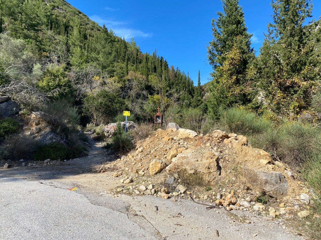
The trail starts 1km from the centre of Vasiliki, easily walked if you are staying in the village. Take the small road turning up the west side of the river running down the centre of the valley (near the Wildwind hotel). After 700m a track goes off left by a white shrine. There is space to park a car taking care not to block any access. The trail starts up the track.
Start of the trail turning off the road by the white shrine.
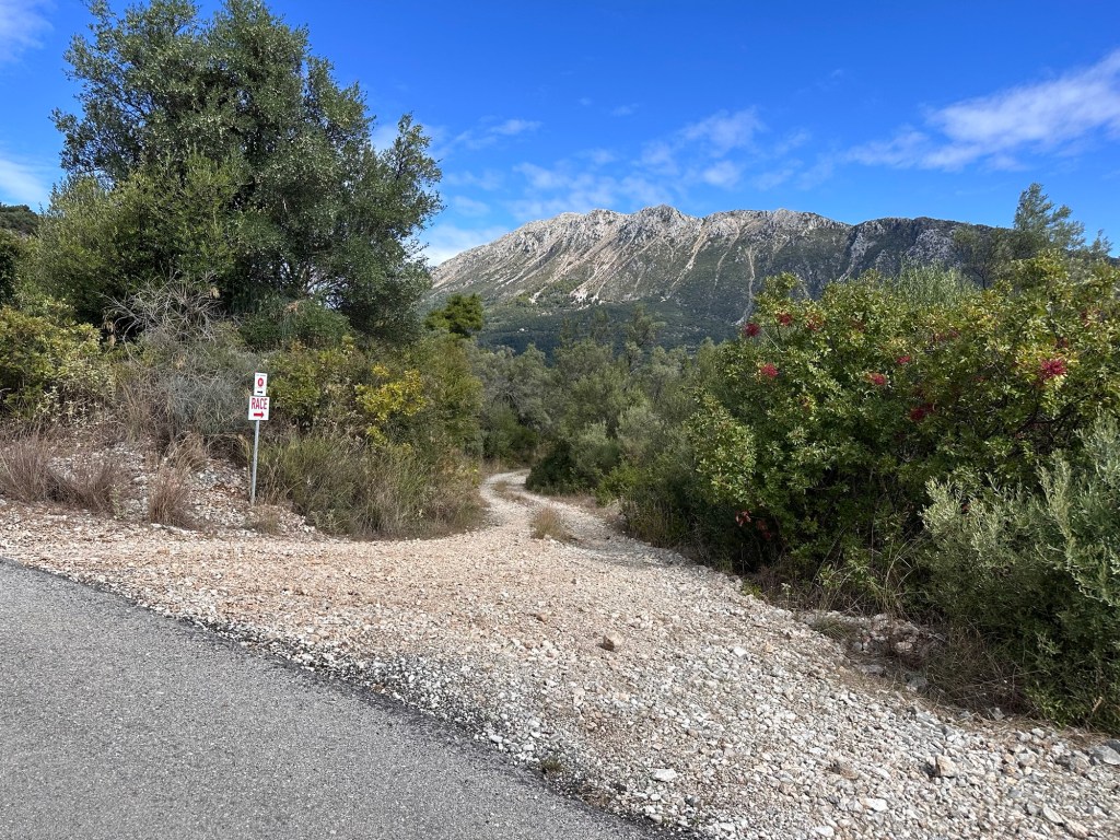
The route has been well signed by the Vasiliki mountain race organisers. So, for almost all of this trail you will follow the red route “R” signs and red painted dots and arrows. As far as Roupakias you also follow the very clear signs saying “Race”. The race was the 2025 42km marathon from Vasiliki – but take care as race routes sometimes change – while route “R” is less likely to change.
The trail soon becomes pretty and rural running through old olive tree groves and then pine forest. At a T junction bear right and immediately right again at a fork. At a cross roads bear right yet again. After 1km you come to a white painted plane tree in the middle of a track junction with a spring running from the rock behind.
Pass a spring with its white painted plane tree.
Keep straight on up the track passing to the left of the spring. For the next 1.5km keep straight on along the wonderful track. It climbs gently as the scenery becomes better and better. Some of the olive trees are huge and must be many centuries old. The views of Lefkada’s highest mountain Stavrotas, across the valley, become closer and grander. This flank of Stavrotas, with huge screes, thrown up by the geological fault running along the west of Lefkada, is too unstable to be climbed safely, but looks magnificent.
After 1.5km you reach a quiet road. Turn left and climb up a few zig-zags of the road. After about 400m another track goes off right heading directly at Stavrotas. Take the track and enjoy the view.
Turn off the road. Views of Stavrotas mountain across the valley.
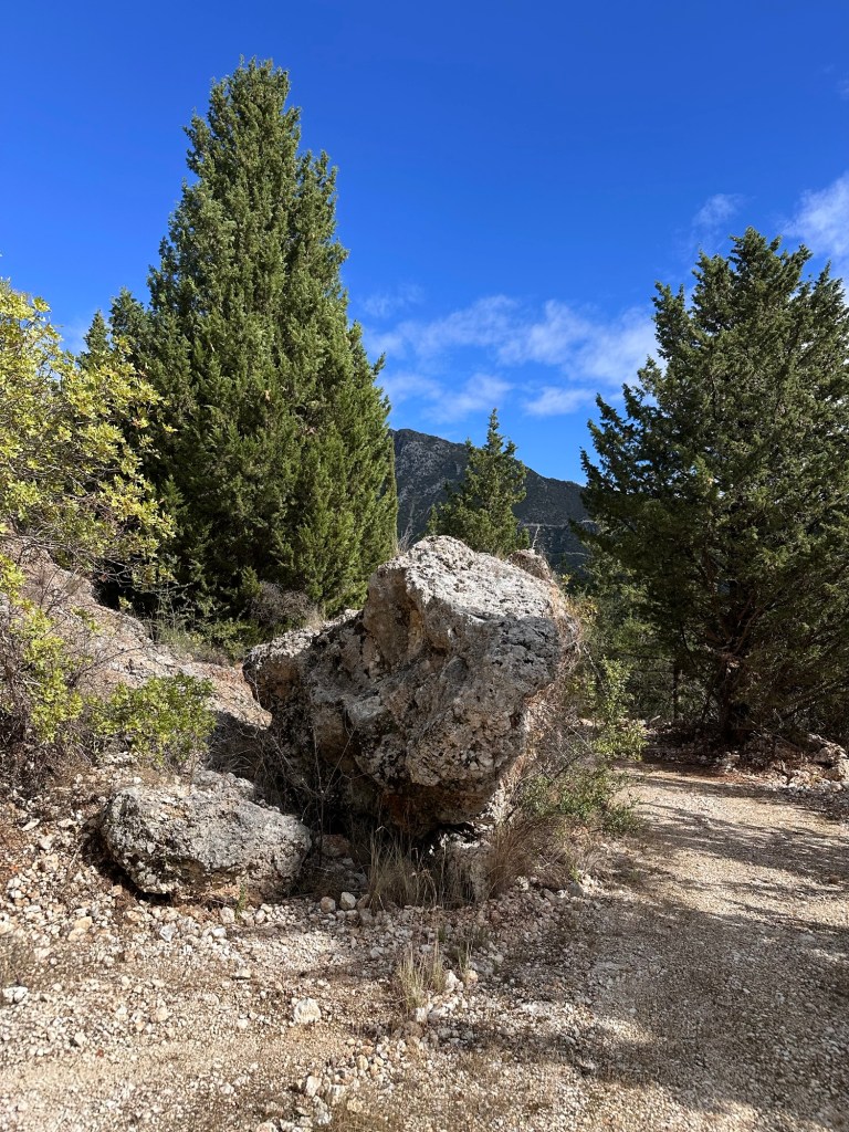
The track continues for another 1.5km running across the hillside going gently up and down as it heads along the side of the valley. Ignore all turnings and keep straight along the main track. You pass a huge boulder sitting on one edge at the side of the track.
Pass a huge boulder looking precarious.
Shortly after the boulder the track becomes a little narrower and part overgrown, but the way through is clear. The track becomes wider again and joins another track coming in from the left. Head right down the slope. After 300m going down take a sharp left. Continue again through huge pines, climbing again a short way until meeting a quiet road. Turn right down the road. After 250m you pass a very pretty church as you start entering the ruined buildings of Roupakias.
Pass the Roupakias church as you enter the village.
Just past the church you reach the bottom of the valley and loop start heading back down the valley. After 100m you pass a few buildings on the right that are still occupied, along with a fine wooden signboard for Roupakias. On the left opposite the sign is a bridge over the stream, well worth a short detour to view the gorge below. The “Race” signs leave us here crossing the bridge.
Beware, there is no handrail or parapet of any kind, just a big drop to the worn rock gully and pools below. If you have young children grab their hands. For much of the second half of summer the stream is dry – in early summer it is possible to swim in some of the pools. There is a track to the river a few hundred metres downstream of the bridge down the road. Take great care on the rocks.
The Roupakias ravine viewed from the bridge, dry at the end of the summer.
Returning back across the bridge, head down the valley on the road. It zig-zags a couple of times and then runs straight down the valley for about 3km. It is very quiet and rural. Eventually the road turns sharp right and then left again after 200m. The road starts to pass various villa building projects. Keep going for another 1km. A sign for route “R” indicates right – but we now leave those signs behind -so go straight on instead. After another 400m take the road fork right. After another 1km the road turns sharp right at a huge double electric pole and transformer – take the track going half-left instead. After 200m you reach a track cross roads beside a smaller single electric pole – go right following the metal fence.
Approaching the track crossroads with single electric pole and metal fence.
Follow the track as it wiggles left and right ignoring the minor turnings into fields and yards. You pass some huge piles of concrete demolition so keep your eyes on the mountains and trees. After 300m or so you return to a road – turn left and follow it.
Keep on the road for 1km through more building projects (perchance finished when you do this walk). You return to the white shrine box at the start of this trail. If you didn’t park your car here keep on for another 700m to the main Vasiliki road.
A wonderful loop walk above Nidri taking you up to the pretty mountain village of Vafkeri, past the charming Agios Asomati monastery and back down by a different track. Along the way are wonderful views back to Nidri and beyond to the islands and Inland Sea.
This makes a great day walk on the mountain above Nidri – through thick forest and across steep slopes. The walk is on a very good track for all but one short section washed away by the rain. There is a taverna at Vafkeri at about half-way along the trail (reports Aug 25 that it is now closed, hopefully not for long).
The trail can be extended along the high level track to Neochori and back to Nidri that way, or as far as Alatro. If on foot from Nidri I suggest getting a taxi to the start and then walk back via Neochori. This is also a route for a mountain bike ride if you can get past the rain damaged section, or if you avoid that by routing via Neochori or Alatro.
You need a car or taxi to take you to the start. It is 6km up from Nidri.
Accomodation and taveras in Nidri. Also a taverna in Vafkeri.
The trail starts 5km up the road from Nidri to Vafkeri – just after the big zig-zag section. You pass one or two villas beside the road and a concrete track goes off left, signposted to several villas. Park without blocking anything and take the concrete track.
The concrete track goes left off the Nidri-Vafkeri road.
After a short distance there are two forks one after another – keep right at both towards Villa El Aquila. Keep climbing up the concrete track. After 850m the concrete track goes up left to the villa itself and an unsurfaced track continues right. The unsurfaced track starts to climb zig-zags up through the rocks and trees. After 1km you start to come into Vafkeri village. Keep going straight on into the village, past a church on your left into the village centre. There is a taverna in the village where you can take a refreshment break.
Just as the track starts to descend steeply a concrete and stone track goes off left sloping down to the road. Go down to the road and turn left.
The concrete and stone track sloping left from Vafkeri just before joining the road.
The road goes round bends to the right then the left to a big spring area on the left with a road going left immediately after. Take that road signposted to “Monastery of the Taxiarches” (another word for Archangel Michael). The spring has some old stones where villagers used to wash clothes, worth a quick look.
Walk up the quiet road through peaceful forest for 1.5km until you get to the semi-abandoned monastery (in the trees off to the left). It is very pretty and worth a short diversion to look around, or even a picnic (leave no litter, OC). If you pass on the 6th September the church will be open for services.
Agios Asomati Monastery
After looking at the monastery continue on the road, through vineyards, for 700m until an unsurfaced track goes off sharp left just after a bend to the right. Go down the track.
An unsurfaced track goes off sharp left after a bend right.
You now start to descend back towards Nidri, with the path zig zagging down the very steep slope. You get great views ahead.
The track zig zags down the steep slope back towards Nidri.
After 1km the track reaches a saddle below a low hill, where there is a junction with another track going sharp left. Take the track left. (If you go straight on you come to another track junction above Neochori – and back to Nidri by an alternate route – or on along the high-level track as far as Alatro).
This trail goes left and down. After going round a few more zig-zags you reach a section where a stream has gouged away a big section of the track. On foot it is possible to get past keeping to the left and climbing down.
The stream has gouged away the track, but still passable on foot.
Continue down the track keeping right, right then left until you reach the road where you started.
If you haven’t got a car or taxi arranged, it is 5km to Nidri downhill all the way along the road. If walking to Nidri it is less road-walking, and nicer, to take the Neochori alternative route.
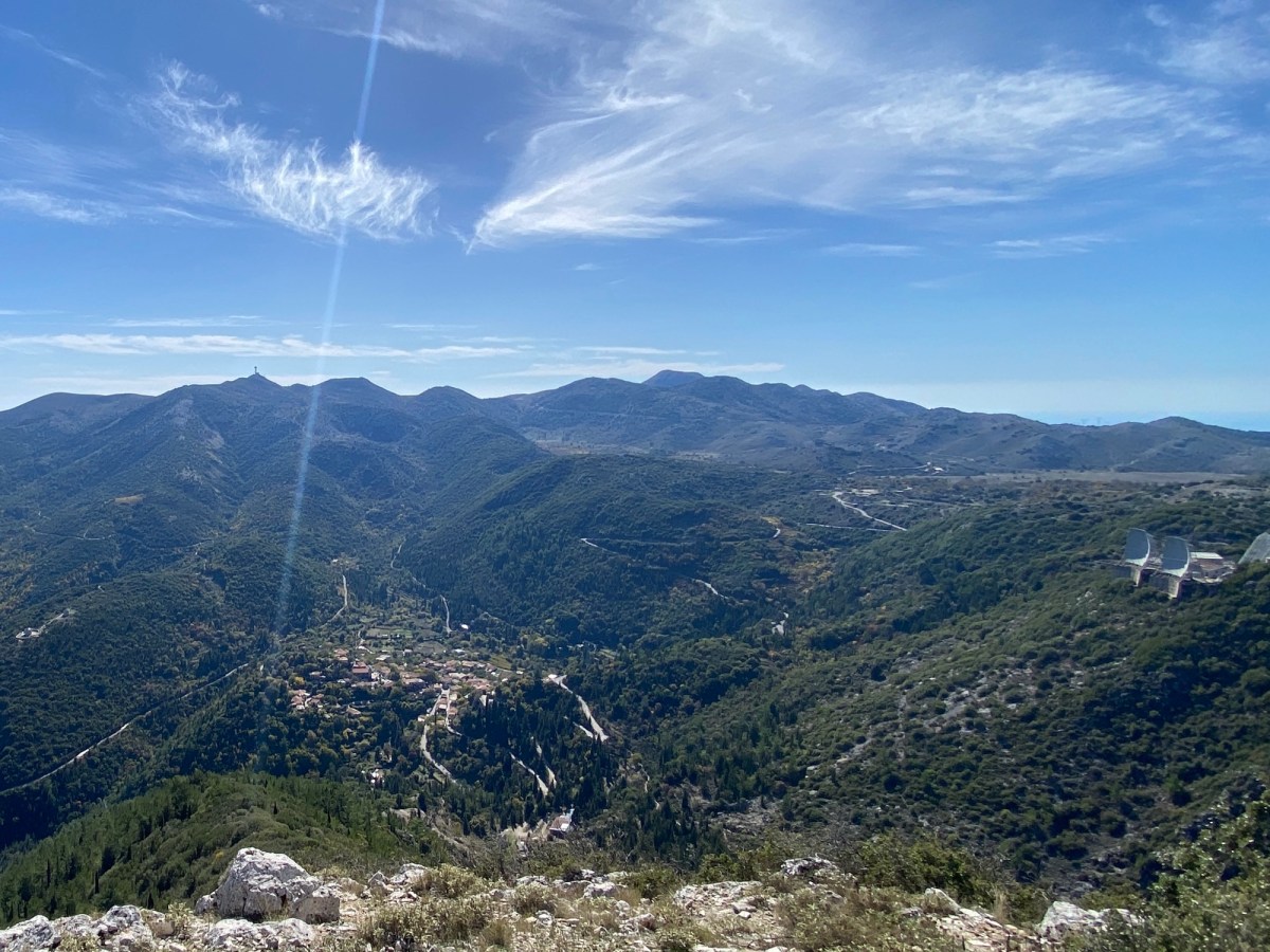
Climb all* the Lefkada peaks over 1000m in one day. The route starts and ends in Eglouvi village with its traditional tavernas. To earn that beer and lentil soup you have to climb a total of 1,345m over 23.3km of rocky mountain paths. Are you up for this mega-challenge?
The route first takes you up Profitis Ilias, then a trek across the lentil plateau to a climb up Stavrotas, the highest peak. The route heads east to Mnimati peak. Then out to the south end of the ridge at Mourrat, back to the far eastern viewpoint at Katharia Rachi, finally descending to Eglouvi via the windmills.
Only do this trail if you are fit and have experience of mountain trails. There is no serious scrambling nor rock climbs, but it is long and over rough rocky paths. Take all the water you can carry – at least two litres each (and more if very hot). We strongly recommend using the GPX file on a GPS app or device to find your route.
* Note that “all” over 1,000m peaks does not include Mega Oros which is an off-limits military radar base. We go close but not fully to the top of Mnimati for the same reason. We don’t include smaller peaks, that are separated from a taller peak with a drop less than 30m. So it is “all significant over 1,000m peaks on Lefkada that you are able to climb without going to prison”. But that doesn’t fit easily on the T shirt.
Tavernas in Eglouvi. No accommodation but Karya is a 4km walk downhill.
Start from the Eglouvi village square. You can get water from the tavernas or from a tap under the plane tree.
Head off up the A3 path to the top of Profitis Ilias.
Walk a little downhill from the tavernas back towards Karya. On your left is a turning with a yellow A3 sign. Take this turning and follow the next yellow A3 signs left, right and right again through the footways of Eglouvi village. The last footway takes you back onto a road heading rightwards up the hill.
The start of the A3 trail in Eglouvi
At the top of the road (just as it turns a hairpin left) another yellow A3 sign points up a monopati heading up a steep valley. Follow up that monopati as it climbs right up to the top on the left side of the steep valley (almost a gorge).
The trail leaves the road just above Eglouvi heading up the steep valley / gorge
The going is pretty steep so take care. You follow yellow and red painted marks on the rocks all the way up.
Climb up the steep path
As you come to the top you start to enter a large quarry area. Keep going up the dry stream bed until you get to a trail junction with the A3 marked going off right. Go right and head over the quarry heading towards the mountain up on the right (your destination).
The junction of the A3 (going to Profitis Ilias) and M4 (going to Karya)
Head up the mountain ahead until you meet a short track heading from a road on your left. It is possible to take that road up to the top, but the A3 trail keeps right along the short track passing a small field. The track then turns back into a monopati climbing further up the mountain. Finally it reaches that road again further up. Walk a short way up the road to the church of Profitis Ilias at the top of the mountain.
The views from Profitas Ilias are equal to the best anywhere
Many describe this spot as being close to heaven. You can see all of the Inland Sea from here – on a clear day to the entrance of the Gulf of Corinth. When you’ve paused to take it in, set off back down the road. Keep going on the road as it passes around and across the quarry finally meeting another road at a T junction. Turn left along the road and then after 100m take a track going off right marked in red, yellow and blue paint.
For a while you follow the red, yellow and blue. The track turns left and then right onto a monopati across the low hills. You rejoin another track keeping straight on and then right. At a point the markers turn right onto another path, you keep straight on along the track until it rejoins the road. Go right and follow the road a short distance to the small church of Ag Donatos and its threshing floors.
Behind Ag Donatos church are several old stone shelters. This view looks back the way you have come.
Follow the road first right and then, shortly after, left heading to Ag Ilias. Follow the road up past twists and turns as it climbs up through the lentil fields. Just before the road turns sharp left on a hairpin at the end of a small valley a track goes off up to the right. Take that track. Keep left at two junctions and the zig-zag up the slope heading up towards Stavrotas. At the top keep right and over the low pass where the track fades for a short length as you cross the high meadow to the track on the other side. Head left up the track.
As you start to climb again the track is blocked and a path starts following the same route as the track but slightly down the hill. Take this path along and up to a small saddle of rocks. The red paint markers help you follow the trail. After the saddle you go left up to the start of the main slope up Stavrotas.
At this point a second path (which you will go down later after summiting Stavrotas) joins from the left with both yellow and red dots. Carry on upwards and slightly rightwards following red dots. Climb up the slight ridge on the left side of a small field system and up onto the steep rocks of the last part of the climb. Do not walk over the fields as they grow lentils even at this high remote spot.
Keep going up to the top. There is a slight false summit just before you get to the real summit. The real one is clearly the highest and has a small cairn, flag pole and shrine box. This is Lefkada’s highest point at 1,182m. The views from the top are in all directions. You can see up North over Preveza to Paxos and Corfu – South to Ithaca and Kefalonia – east to the Gulf of Corinth – west out over the Ionian Sea.
From Stavrotas looking south. The southern peak is lower and less than 30m of height separation. So not included in this trail.
After resting a while head back down the way you came to the path that came up from the left (now right). Head down that path. The way is not all that clear but you are heading down the right side of the small valley to the bottom where it passes a high goat hut. There is sometimes a dog chained up which you can avoid passing around either left or right to the track in front of the hut. Head right and down a short way until you reach a road.
Stavrotas showing path down, coming over ridge to right, passing a hut, and onto the track going left.
Turn left and head up a short way to the top. Another road heads off right heading to the communication masts on the top of Mnimati. Walk up this road, it is usually very quiet. Just before you get to the masts themselves a path crosses the road marked by red yellow paint. Follow the track off right as it descends a track past a small hut.
Follow the track off to the right before the antennas
Follow the track with red and yellow paint blobs as it winds down over the high plateau of Elati past several small hills. Ignore where the red and yellow paint marks go off left leaving the track on a path (you will go that way later). Soon the track stops on the ridge running north-south with a view down to Nidri. Climb up a faint monopati running along the ridge up to the peak of Mourat at 1,037m. This is the most southerly peak on this trail.
Your destination ahead on Mourrat peak
When ready head back the way you came to where the red yellow markers went left (now right). Follow the markers as they cross a field and then climb up to Katharia Rachi. This is the last peak at 1,085m with its stunning view down to Nidri and out over the Inland Sea.
Stunning panorama view from Katharia Rachi
Turn back almost the way you came but following the red yellow paint a little to the right heading directly back to the antenna masts on Mnimati. Follow up and down along the ridge passing the masts on the right-side and then descend towards Eglouvi. The ridge is fairly steep down so go carefully. Towards the bottom of the ridge the paint marks will take you around the right of a small vineyard and then down to a road. Head left a short way to a track heading up right.
Walk up the track to two windmills with their view out over central Lefkada and Eglouvi. Take the monopati down left behind the first windmill as it descends to the village. Follow the markers along the road to the centre of the village – straight on, right, left, right, left, right and up the steep path to the back of the tavernas.
Congratulations. You’ve completed the challenge. I strongly recommend the tavernas to refresh and celebrate. In fact you will often find me sitting there having lunch or an evening beer after a walk. I recommend trying the lentils – either as soup or salad. They are the best lentils in the world and a fitting meal for a champion hiker like you.
You can give a toast of thanks to the mountain runners of Eglouvi that maintain most of the monopatis you have walked. Theirs are the painted blobs indicating the various length runs. We are very grateful to them for keeping these paths open.
A beautiful loop between Syvros and Vournikas and the lush valley that surrounds them; above Vasiliki. The walk passes several springs, streams, waterfalls, and old water mills (the water runs all year). This superb classic route has been recently cleared and revived by the Antelikos Sivros Cultural Club led by the inspiring Vasilis Deftereos. They will happily guide you round and tell you the history of this ancient part of Lefkada. Do not miss the chance of walking with them.
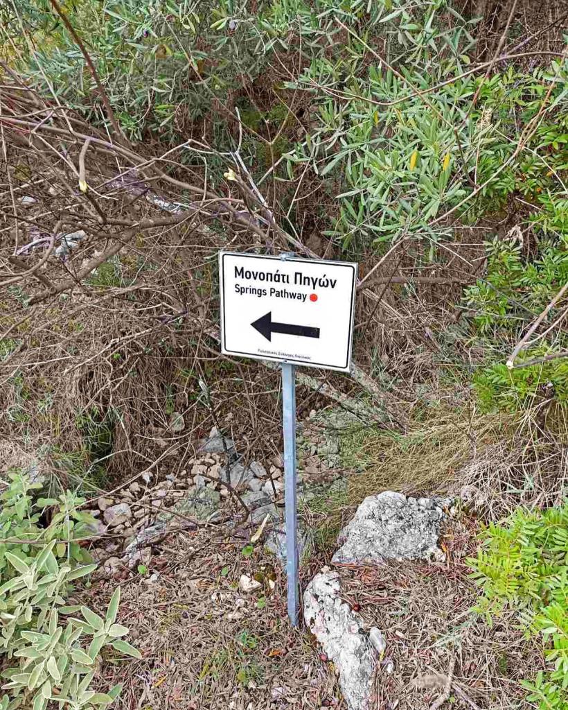
The Springs Pathway is now marked with clear signs. Confusingly the route had been marked using red paint several times taking different routes each time. Most recently a mountain race was run using part of the route. The best advice is to ignore the red painted blobs and arrows at the junctions of roads and tracks, often they point in completely the wrong direction. The new signs make the trail much easier to follow. Still a good idea to have the GPX trail in your phone GPS map app too. Also ignore old signs showing the whole trail on an arial photo map – it has changed since then.
One of the new signs that mark this “official” route.
The route is well shaded for most of its route and so can be used in all but the hottest mid-summer days. For optimum shade start at 9am or earlier. It is easily shortened if you don’t want to climb up to the highest spring or prefer to miss the steepest paths. You do need good walking shoes and carry a bottle of water, which you can replenish as you pass the springs (apart from the few specifically marked as do-not-drink).
You ideally need a car or taxi to reach the start of the trail. There is an infrequent bus to Syvros.
Tavernas and accommodation in Syvros and Vournikas.
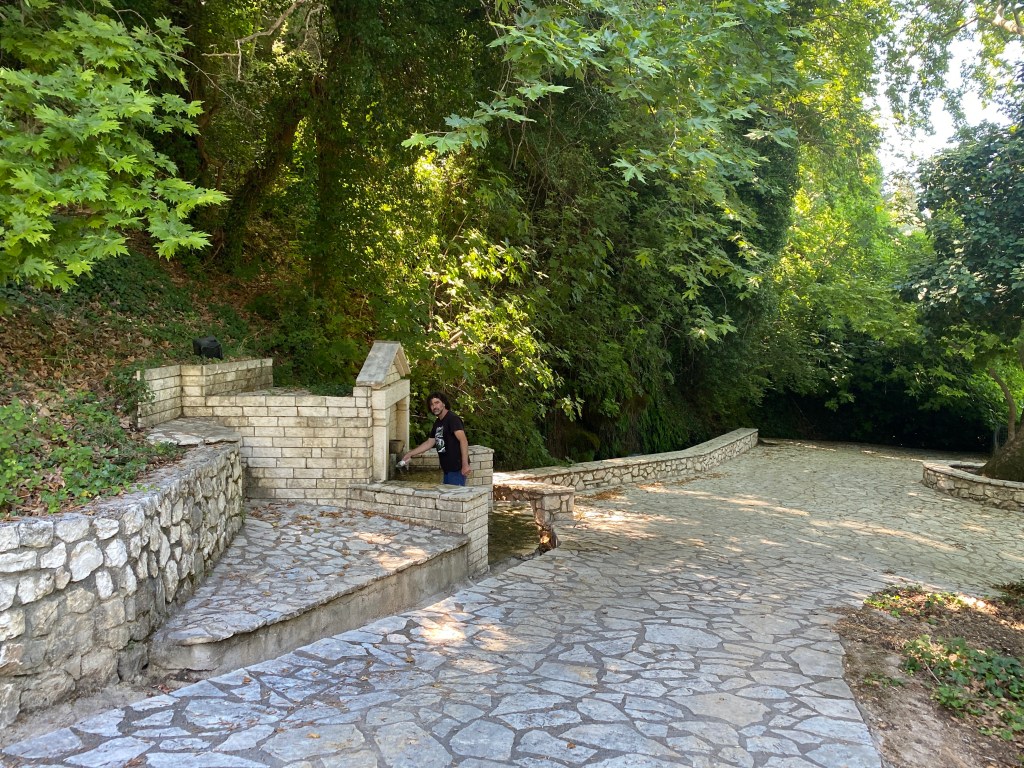
Start from the Syvros village square. There are tavernas to take refreshment before you start. Head off on the road heading up to Agios Ilias on the north side of the square up the right of the old schoolhouse. At the first turn of the road to the left take a track going off right. After a short distance fork right and then fork left. You re-join the Agios Ilias road up right for a few metres and then take another track off right. Follow the track keeping right at each of two forks until you reach a large, paved area with a spring in an alcove of the wall and a delightful small waterfall over mossy rocks.
The first spring beside a large, paved area.
There is an option here to considerably shorten the trail and skip the steep mountain section and the highest springs. Go up the path passing directly up and behind the spring and take the track direct to the Gazina Spring (below). From there pick up the rest of this trail. You will miss two great springs and fantastic views, but it makes a much easier trail.
For the full trail, after admiring the spring, head back almost the way you came but keeping right going up the hill. After 100m a track forks off right. After a short distance the track hairpins right and a path continues straight on through an olive grove. The path rejoins another track where you keep right. Follow the track as it crosses a ford where gravel has been taken for local building projects. A track goes right just after the ford and climbs to where a path goes off left following up the course of a stream.
The start of the path heading up along a (usually dry) stream. The red arrows are safe to follow.
For this path only you can safely follow the red arrows and blobs climbing up the hill. You meet a track where you continue to follow the red arrow right. After a short distance you meet another track where you go left up the steep slope.
The track climbs up the steep slope.
Keep on climbing the hill until an almost parallel track to your right finally joins the path you are on. Keep on up for 100m until there is a group of plane trees to your left. In the midst of the trees is a very welcome spring. This is the highest point of this trail. Stop for a while drinking the clear water.
The highest spring on the trail and the welcome shade of the large plane trees.
After a break head back down the track you came up but this time keeping on the left-hand parallel track as it heads down and across the steep hillside. This section gives you fantastic views over the Vasiliki valley. The track passes some goat sheds up on the left but keep going down and across the slope.
The track traversing down the steep hillside with views of the Vasaliki valley. Note the welcome shade provided by an early start on this route.
The track becomes less clear as it traverses across the hillside. After about 1km the track becomes a monopati and becomes very steep and scrambly. Take care. Ignore paths heading down the hillside and keep going across the slope.
Eventually you meet a path with marked yellow blobs going left straight up the hill – don’t go up, keep going across and slightly down. After about 200m you arrive at the Klimatsa Spring with two white columns in the water. This spring is very pretty but the water is currently not safe to drink. The Klimatsa Spring is associated with ancient pagan rites here and on a nearby rock.
Pretty Klimatsa Spring with two white columns. You arrive down the track on the right and leave down track on the left.
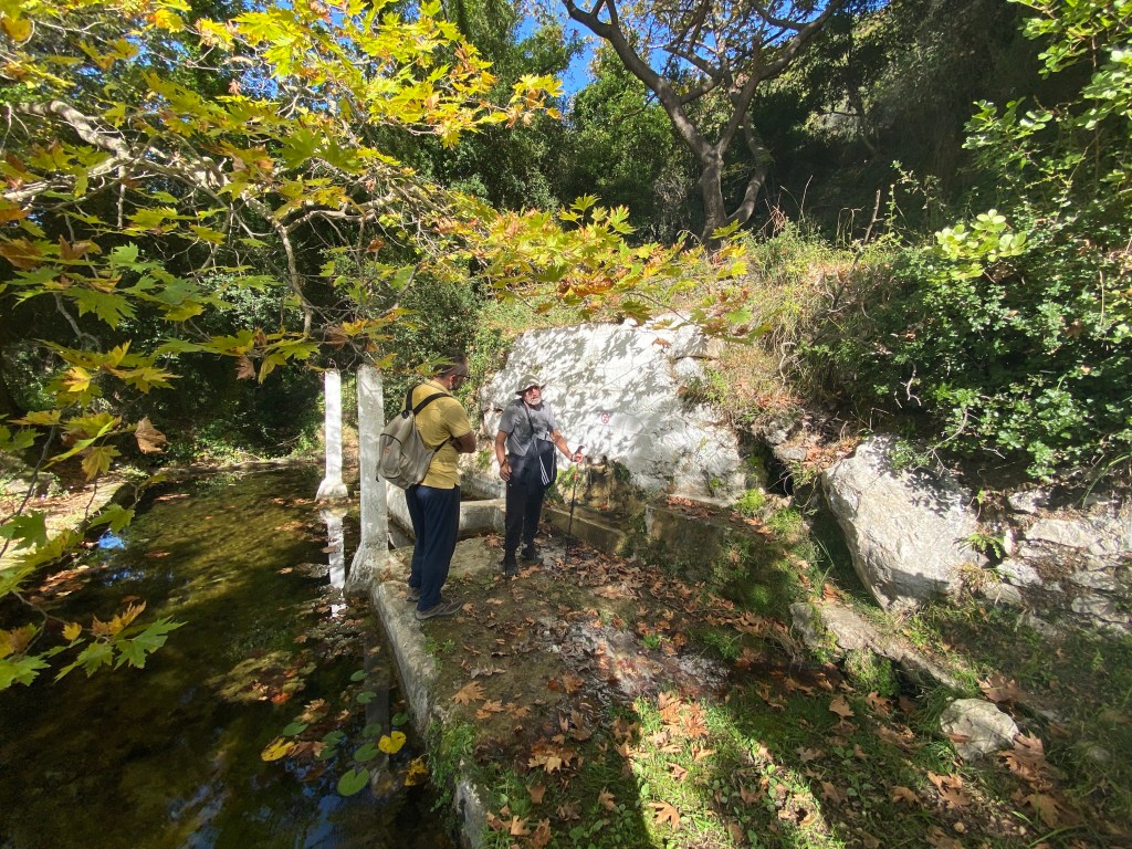
Take the path going back past the spring on the downhill side. Follow a track threading between the old stone buildings of Vournikas, some sadly derelict. It is safe to follow the red paint blobs for this section. Reach a surfaced track and almost immediately the covered Gazina Spring beside a cool pond. Take a look at the stone basins that were used to wash clothes. The water is very good to drink.
The covered Gazina Spring and pond with old stone clothes-washing basins.
After refreshing retrace your steps back 50m and take the fork right heading down the hill. Join a tarmaced road zig zagging down the hill. After three zigzags a track goes off right. After 300m the track crosses another road and then continues down the hill. Just after crossing the road a track goes off left. Go 70m down that track to the Kanali Spring before returning and continuing down the track to the right.
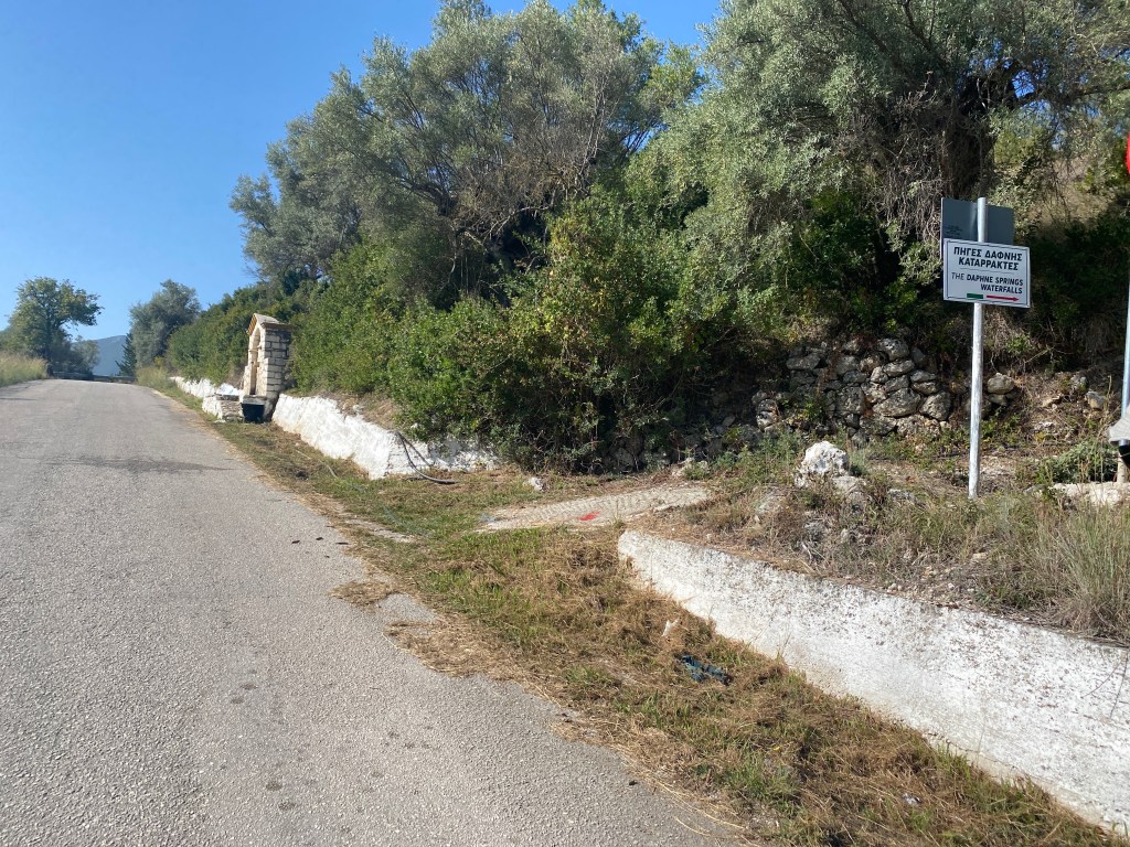
The track is concreted for most of the way. It descends a valley down to another tarmacked road. This is the lowest point of the Springs Walk. Follow the road right as it goes up for about 200m. On the right is a track signposted to the Daphne Spring.
The track goes off right signposted to the Daphne spring and waterfalls.
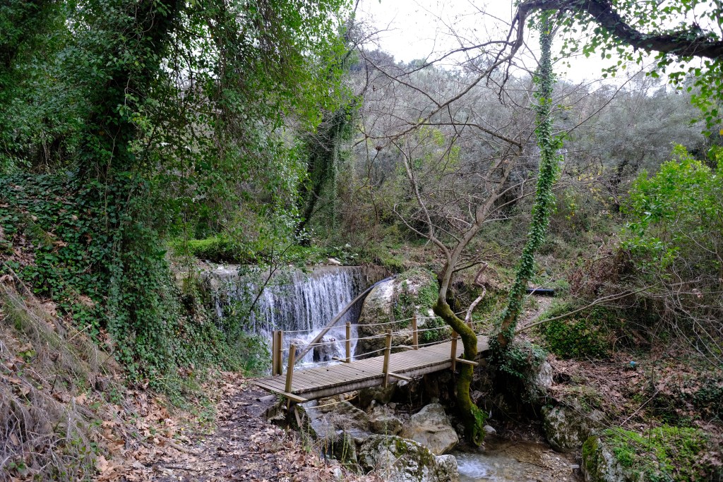
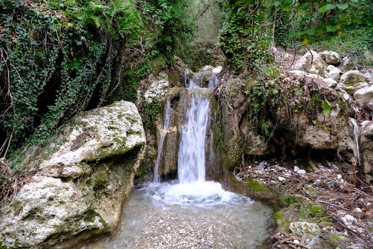
Take the track, past another spring, and keep right as it becomes a path, crosses a wooden bridge, and goes up the right bank of a stream passing several waterfalls. This section of the trail is very pretty.
Several pretty waterfalls along the path at Daphne spring.
Climb up beside the stream on this magical path through the trees with wild-flowers and wildlife. After 1.5km you reach a paved area and then climb some steps to a roadway.
Follow the road up right for 200m to a track going off right. Take the track keeping left until you rejoin the road again just before it passes back to the Syvros village square. This is where you started. Take more refreshment at the taverna.
A huge thanks to the Antelikos Sivros Cultural Club, especially Vasilis Deftereos who inspired this trail. They reopened this trail and regularly take groups around giving a fascinating description of the village, wildlife and fauna. Take a look in their small museum too if you get the chance (in the old schoolhouse at the start of this trail). You can also learn Greek dancing at their weekly evening session.
The trail is the fifth part of the Lefkada Trail running from the base of Stavrotas over to the start of the long tail of Lefkada down to the south. The walk crosses the Vasiliki valley descending down past the magical springs and waterfalls of Syvros before climbing back up to Ag. Petros. This sets you up for the final day of the Lefkada Trail day 6 Ag. Petros to Cape Doukato.
The trail is along unsurfaced tracks and paths for much of the route – with just a few kilometres on very quiet roads.
The trail starts where we left off day 4 outside the taverna in Ag Ilias (just below entering the narrow one-way system within the main village). Head down the road towards Syvros. After 400m the road curves to the left where a log-clad house is on the right. Just before that house a concrete track goes right running down behind the house and becoming an unsurfaced track.
The track goes right off the road behind the log-clad house.
Keep right at the fork and continue until you re-join the road. Cross straight over the road and take the unsurfaced track heading down. Keep right descending down the track. For a short distance the track almost re-joins the road on the right, but continues on down. A section of the track is part-overgrown but continues as an easy path before becoming a track again. The track descends steeply on a few zig-zags until it reaches a less-steep section. On the right of the track is a large plane tree and the topmost Syvros spring. You can stop here for a rest and the water is pure and delicious.
The highest Syvros spring under the huge plane trees
Continue down the track you left to enter the spring. After 100m a second track forks right (running down just below the lefthand track gradually getting wider apart). The righthand track is less distinct so look carefully. Where you see some metal-sheet goat-sheds up to your left a track goes sharp right. After 50m a path descends straight down left. There are a number of red paint marks to follow from this point, but many of the red arrows point back the way you came (ignore that fact). Descend the steep track (take care) along a stream bed (with water in winter). At the bottom you pass a junction and then meet a track fording the stream to the left. From this point stop following red marks, and take the track left and down.
After 200m from the ford a path forks off to the left. Take the track through olive trees keeping right at the second fork until you meet a track. Go left along the track for 150m to the second spring. This one too is good to drink. There is usually a waterfall over the moss beside the path – very photogenic.
The second spring in Syvros. The mossy waterfall is behind the wall.
Head back on the track almost the way you came, but taking the track going left and down across the slope. After 200m turn left to a T junction where you go left again. Round a bend past an old watermill you re-join the road briefly. Turn left down the road and then immediately left again on another track. Keep right then left continuing down until you join the road again. Follow the road a short distance into Syvros village square with its water channels and tavernas. Time for a coffee or more.
When ready leave the square along the road to the right from where you came into the square. Go around the corner of the schoolhouse building and after 50m take the track going left. If you reach the post office you went too far. Down the track keep right and then right again. You soon re-join the road going left down hill. Just past the car service yard a paved path heads off left down to Daphne Spring.
Keep going down the Daphne Springs path for about 1.5km past the spring itself followed by several waterfalls and cascades. The path is delightful. Just below the last waterfall the path crosses a wooden bridge. Note there is another wooden bridge just before the real one leading to a dead-end. After the bridge head down left past a final spring until you re-join the road.
Bridge across the stream after the last waterfall (looking back the way you came).
Turn left down the hill, then round a right hand bend to a junction where you turn right (signposted to the cemetery). After 0.5km keep left at the road fork. After a further 1km the road turns sharply to the left and a track goes right (almost straight on).
A track goes off right on the corner of the road.
Take that track going left at the immediate first fork then turning right a little further on. Straight on until it re-joins a road. Go right along the road as it gradually climbs up the valley. After 1.2km the road passes some huge olive trees and an unsurfaced track heads off left up the valley through some trees. Take that track and climb up towards Ag. Petros.
The track goes left off the road just after some large olive trees.
Keep right and then left, generally keeping to the track zig-zagging up through the woods. When you reach a road go right and then straight up, ignoring turnings, up the very steep road into Ag Petros itself.
Here you join the main road down the west of the island. There are tavernas as well as some accommodation for the night.
This walk runs between the mountain villages of Eglouvi and Ag Ilias. It climbs up and over Mount Elati visiting the high peaks of Katharia Rachi and Stavrotas before descending to Ag. Ilias. This takes you over the highest part of Lefkada; crossing from the north to the south of the island. The trail is along monopati and unsurfaced tracks for almost all the first half of the route – with a quiet road descent on the other side.
The trail is the fourth part of the Lefkada Trail. It is one of the hardest days as it climbs high and is long too. The full route takes you over both Katharia Rachi and Stavrotas. Katharia Rachi is the end of a ridge and has the best view in Lefkada. Stavrotas is the highest peak on Lefkada. If the day is too long for you then you can easily skip one or the other of these. But do come back when you have finished the Lefkada Trail and do what you missed on this day. Otherwise, you don’t get the T-shirt 🙂
Start in Eglouvi in the main square with the tavernas. If you haven’t got water fill up now – there will be no more drinking water until you get back down. There is a tap next to the plane tree or buy from the tavernas.
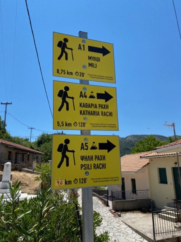
Start of three trails in Eglouvi; even the corrected distances are wrong
Go up and round to the left of the tavernas and down the narrow path to the right. You will soon see the sign for the start of three trails. You follow A4, and A1 will accompany you as far as the windmills. You follow red and yellow paint markers and A4 signs all the way to Katharia Rachi for the first part of this trail. They are pretty clear for most of the way.
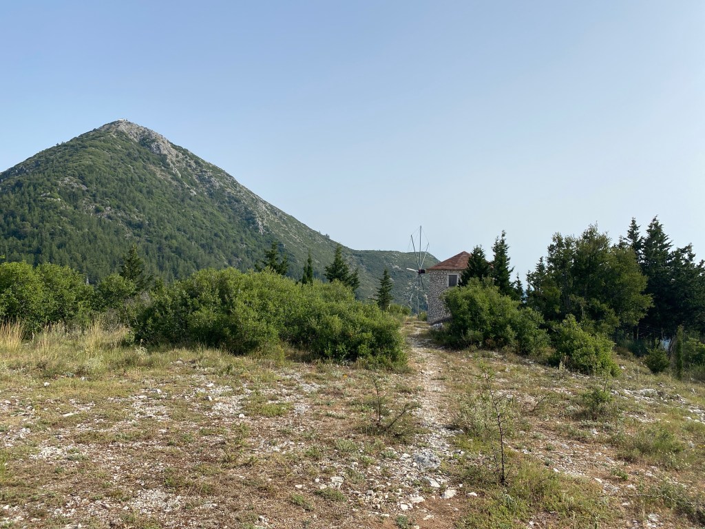
Walk through the quiet village roads until you see a monopati heading up to the left up the hill. Follow this diagonally up until you reach the windmills.
Approach to the windmills. This trail goes up that ridge on the skyline.
After exploring those and enjoying the view take the track up to the right behind the windmills. Follow to a surfaced road. Turn left and follow around a few bends until there is an unsurfaced track going off right. The track has a read and yellow arrow painted on the road pointing where you need to go. Beware there is a second track a few hundred metres later also with a red and yellow arrow. Make sure you take the first.
Track off right with yellow arrow marker – note now red and yellow
The track approaches a vineyard where a monopati branches off left. It skirts around the vineyard and starts to climb the ridge. The monopati now goes up the crest of the ridge to its top. This is a steep climb but you get fantastic views all the way up – a real classic. There isn’t much shade but it is well worth the effort.
At the top of the ridge the monopati becomes a narrow track going past a very small lentil field (make sure you go round not over). The track turns right to head up to the radio masts on the top of Mnimati, but the A4 monopati actually goes straight on and slightly downwards. Make sure you don’t miss the monopati painted dots.
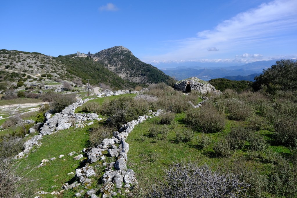
The monopati is now much easier following down to a small pass and then gently up the ridge to the top of the peak. Finally you get to the sign indicating the end of the A4 on Katharia Rachi.
Below you is a wonderful view down to Nidri – with all of the Inland Sea and islands behind. If you have eaten at one of the tavernas at Geni and looked up – this is the steep crag fringed peak you will have seen above you. A fantastic place to sit and enjoy the view. Stand where Odysseus did.
The end of the A4 trail. And a great place to sit and take in the view.
When you have finished looking take the path heading sharp-right almost back the way you came. The same red and yellow paint marks descend down and right down to high pass below you. After about 200m the marked path turns back left and descends more gently to the pass. The path then turns right and goes over a low hill until it reaches a T junction with an unsurfaced track. Follow the painted marks off right.
Follow the track as it winds across the high plateau. There may be wire fences to cross but most have tied “gates” where crossing the track. Leave them as you found them as they stop the cows roaming.
Track winds across the high plateau
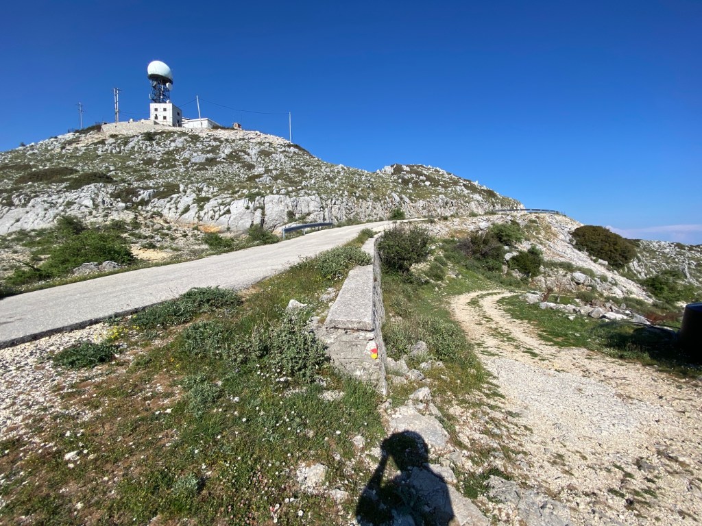
The track eventually climbs back up to the road near the radio antenna at the top of Mnimati. At this point leave the paint-marked trail and take the road going left away from the masts.
Follow the road left away from the antenna
Descend the road for 1.5km until you reach a junction. Take the road left going down towards Ag. Ilias. After a few bends there is a track off up to the right. Here you have a choice whether to climb Stavrotas up above you or to carry on down the road to Ag Ilias. The route up Stavrotas from here is 1km long and 220m of climbing – and then back on the same route. If you do climb Stavrotas, and being Lefkada’s highest mountain you really should if able, you will eventually return to this point on the road.
The track heads into a small high valley with fields and pasture. Very shortly you reach a small hut on the left where the track divides. Take the left track running past the hut on the left hand side. There is often a dog attached to a chain blocking the track – but this is easily avoided with a path that run around to the left and then re-joins the track.
Distant view of trail up Stavrotas. Track comes up in lower left (the road just out of shot), past the hut, up to the ridge line up on the right, and then up left to the summit.
The track turns suddenly to the left and heads straight up the steep slope – at this point carry on straight ahead on the path that goes off right.
The trail is marked in both red and yellow dots and steadily climbs up the slope going diagonally to the right. It is unclear in parts so a GPS map helps. Goats don’t have GPS and make several tracks – but keep going to the ridge up and right. After a climb the path goes over a small ridge marked by two large yellow painted arrows on the rocks.
At this point a second path joins from the right marked with red dots (Stavrotas from road above Eglouvi). Carry on upwards and slightly rightwards following the red dots. Climb up the slight ridge on the left side of a small field system and up onto the steep rocks of the last part of the climb. Do not walk over the fields as they grow lentils even at this high remote spot.
Keep going up to the top. There is a slight false summit just before you get to the real summit. The real one is clearly the highest and has a small cairn, flag pole and shrine box.
The views from the top are the best in Lefkada. You can see up North over Preveza to Paxos and Corfu – South to Ithaca and Kefalonia – east to the Gulf of Corinth – west out over the Ionian Sea.
South over Ithaca and Kefalonia
Retrace your steps back down the path until you reach the road where you started up Stavrotas.
Descend down the road about 3km into Ag. Ilias village. If you use your map, there are a couple of paths down this slope as alternates to the road, but very rough and overgrown and indistinct lower down, so hard to recommend (use your discretion and scrambling ability).
The road passes a monastery and bell-tower viewpoint. Near the village the road becomes a one-way system (the roads being super narrow in the village). Best to follow the right hand side where cars also descend. Just as the road recombines there is a very welcome taverna.
Well done, you have just done the hardest day. Take a well earned rest and consider day 5 tomorrow – being much shorter and much less climbing. There is limited accommodation in Ag Ilias. There is much more accommodation and tavernas in Syvros a few km further down the road (walk taking a very good path running to the left of the winding road). Or arrange a taxi or lift back to your base. Day 5 will start back in Ag. Ilias – or in Sivros if you walk down to overnight there.
This walk runs from Lefkada Town main square to the small harbour of Nikiana. The route passes the ruins of the ancient capital city of Lefkada, Leucas or Nirikos, where you can see sections of the huge city walls and the ancient theatre. It takes in the pretty mountain village of Katouna about half way (there are tavernas there and both ends). The trail is inland in the hills above the coast for most of its route. This way you are walking along unsurfaced tracks for much of the route and completely away from the busy coastal highway. You also get some fantastic views.
14.5 kmDistance
480 mAscent
ModerateGrade
Features
Lefkada Trail Day 1Point To PointVillageAncientForestMonopati
The trail is the first part of the Lefkada Trail. Also great as a one-way hike getting a bus or taxi back to Lefkada Town. It is easy walking underfoot and there is a fair amount of shade with taverna just over half way. It makes a good hot-day walk if you start early. In winter it is good for low-cloud days.
The trail starts from Lefkada main square. Go through the small streets towards the marina. At the main roundabout take the turn past the schools and then out towards the Nidri road. When you pass Lidl go right a short way to a small road going left beside a car wash. You leave leave urban for olive groves and hills.
After 200m take a track off left
After about 200m take a track off left. Keep right as this climbs up the hill.
You are walking past the site of the ancient city of Leucas or Nirikos founded in 700BC, much of it is now stones in the trees. However the walls and theatre are exposed and you can imagine some of the rest. The wall starts being visible as you get to the top of the hill but gets better defined as you go along. It is distinguishable from field walls by the huge stones and defensive positioning on the slope. It comes in from your left and then runs along the right side for about 500m.
Part way along this section is a track going down left with painted arrows coming up. You have the option to take a short diversion: go down about 100m and then take the fork off right – after another 200m you come to the ancient theatre. If the gate is closed don’t go in, but often it is not. This theatre is the first one discovered in the Ionian Islands and demonstrates the prominence of Lefkada in ancient times. Retrace back up to the main track where you left it. The sign says take no pictures – so we borrowed an official one.
The ancient theatre of Lefkada with a very small amount of planned reconstruction.
Just after the track becomes concrete, and climbs steeply, is the best part of the wall. It cross from the right to the left, with massive blocks tightly jointed together. This is just below what was the ancient acropolis for the city, up in the trees. The wall fully surrounds a square kilometre of land from here down to the water below.
The ancient city wall beside the trail
After 1km past the old city keep straight on to join another road going left. The road climbs the hill with hairpin bends. It passes the very pretty Ag. Nikolaos church and then traverses along the fir-clad hills of northern Lefkada.
Passing a very pretty church of Ag. Nikolaos
The road keeps changing between unsurfaced and concrete (usually on the steep bits). After 1.5km there is a road going left by a brown sign in Greek pointing back the way you came. Take the road left descending the hill.
Brown sign pointing back the way you came – turn left.
After a hairpin right there is a track going off right just as the road hairpins left again. Take that track. Descend through the trees ignoring turnings to the bottom of the valley. The track meets another coming down the valley along a delightful stream. Keep left downstream. You join another track and cross a ford. Then continue on the other bank going downstream. The trail forks right crossing the stream once more over a concrete bridge. Just 40m past the bridge take the second path right going up the hill.
Climb up through fine pine and olive trees
Climb following the path, through fine pine and olive trees, going generally up, ignoring side turnings servicing olive groves. After 0.5km you meet a concrete road. Turn right going gently uphill for 150m to where a monopati turns sharp left back up the hill. Climb the wonderful monopati to Katouna village.
Wonderful monopati goes up to Katouna
The monopati joins the road towards the village main square. At a sign to Karia and Lazarata this trail will go straight on, but first go left into the square and three tavernas. One is open all year closing only during afternoon in winter.
Katouna village square with tavernas
Return to the trail going left and follow the road up through the pretty village. Keep straight on climbing until you get to a large disused building with several large eucalyptus trees outside (which you can see ahead as you come through the village). Keep right then left keeping the building and trees to your immediate left. Just past the building turn right at the slightly staggered cross roads. The track is now unpaved saved for a few concrete sections past villas. As it starts to descend you see your destination at Nikiana port ahead. Skaros mountain, to the right behind the port, is your target tomorrow.
Nikiana port with Skaros mountain to right
Keep right at the first fork near building plots. Leave villas behind and descend the track about 1km to a turn off sharp right. Go right as the track becomes grassier. After another 1km go left at a T junction. After a concrete section down a steep hill go second right down the small valley.
Turn second right down the small valley
Keep going straight on past some villas. The track joins a tarmac road over a bridge. Turn left and walk along the road following the stream until you reach the main Lefkada-Nidri road. Turn right and go a short distance around the bay into Nikiana along the wide verge. Take care as some cars go very fast. There are good swimming beaches around the bay followed by shops, tavernas and hotels along the road and in the small port.
Nikiana port
An alternative to the short section of main road is to go right as you first join the smaller tarmac road. Walk about 1km to a T junction and then go left into Nikiana. This goes past quite a few compounds with noisy dogs.
After a rest in the tavernas you can return to your base – there are frequent buses running between Nidri and Lefkada town that stop near the port. Or stay in one of the hotels in Nikiana if on the The Lefkada Trail and tomorrow you set up Skaros on day 2 Nikiana to Karya.
If on The Lefkada Trail then there are also options to stop in Katouna overnight.
This walk runs from the mountain village of Ag Petros down to the cape and lighthouse on the south tip of Lefkada. It follows a set of tracks running through the pine forests on the long tail of Lefkada. The trail is mostly monopati and unsurfaced tracks for the the first half of the route – there are fairly quiet (depending on season) surfaced roads as you get near the cape. It gets pretty remote down at the cape.
An alternate start is from Vasiliki. Walk across the bay and climb the steep zigzag path straight up to the the pass. Keep over to the right near the top and join the track described below just after the mobile phone masts.
The trail is the sixth and final part of the Lefkada Trail taking you down to the southern tip. It is a relatively easy walking (but long) and gives a fine range of views as you head down to the cape.
Start off from Agios Petros heading up on the road towards Chortata. Keep going out of the village through the large pines. Be careful of cars as it is a busy road. After 500m there is a concrete ramp up left leading to an unsurfaced track heading back south.
Turn left on the track 500m north of Agios Petros
The track runs across the slope and gently climbs. You get great views out over the Vasiliki valley and beyond to the south coast of Lefkada. Vasiliki has a long-held world reputation for windsurfing and you will likely see surfers in action in the bay. The hill you are on generates regular afternoon breezes which, combined with the sheltered flat-waters, makes perfect windsurfing conditions.
The view down to Vasiliki
After 3km you pass mobile phone masts to the left then right – ignore the forks left then right to those mast – keep straight between them. You then curve right up to the pass between Kouforpodi and Mega Vouno. After you go over the pass (just before a concrete rain-collection tank) you get to a very muddled crossroads with paths going everywhere. You want a clear track going left along the ridge south.
The track heading south just after turning left at the muddled crossroads
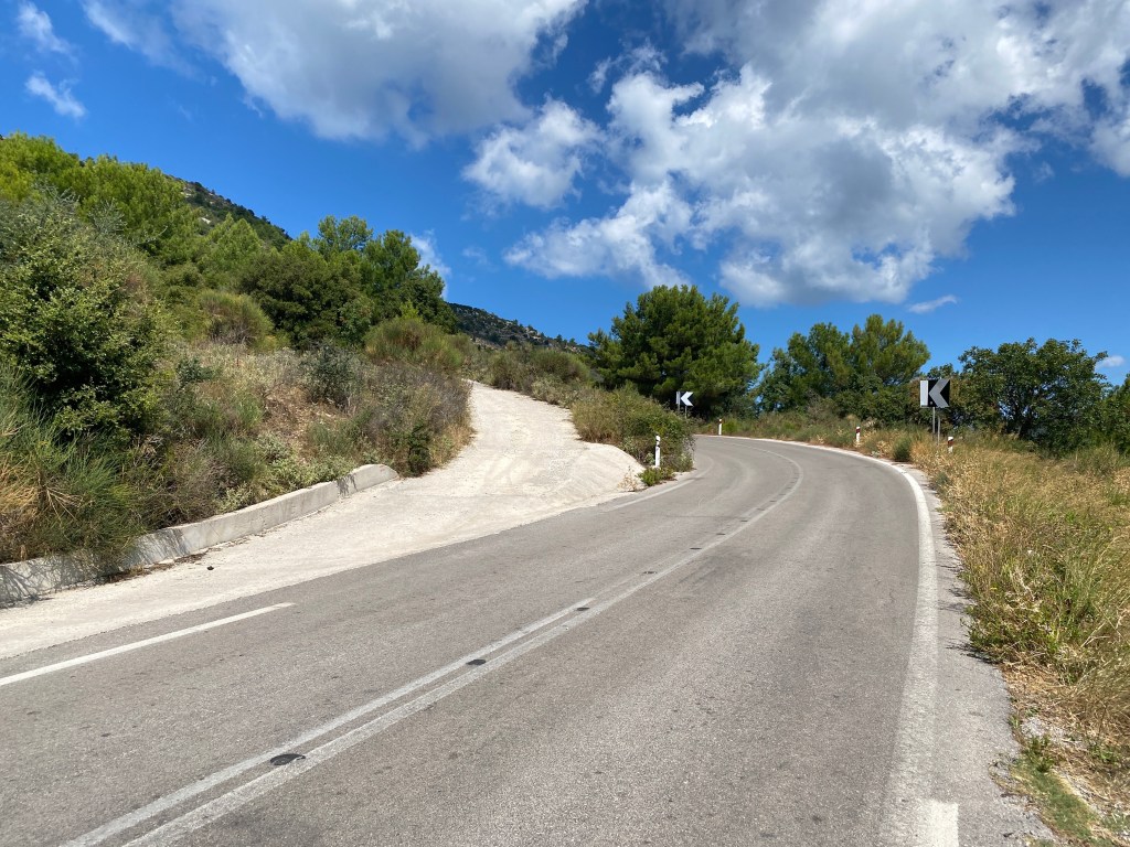
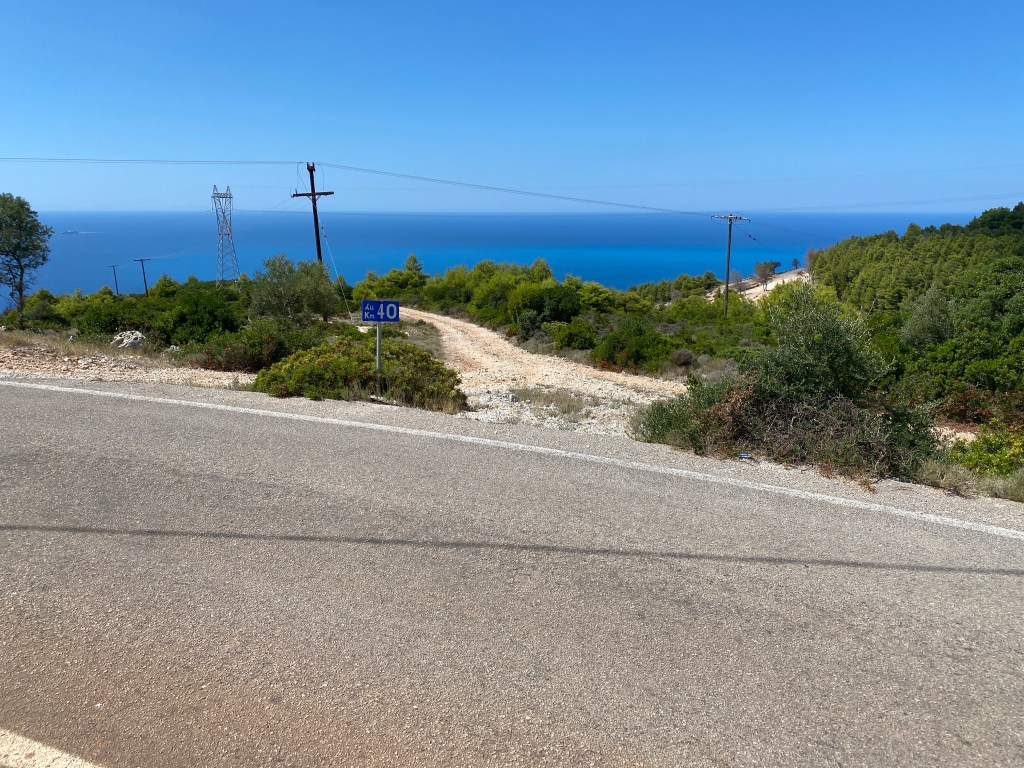
The track now follows below the ridge line as you head south. You get great views down the steep fir covered steep slopes to the west coast of Lefkada. After 4.5km you descend to a tarmac road. Turn left along the road. Almost immediately there is a summer-only kiosk selling drinks and snacks. Past this after 400m there is track heading right down the slope. There is a “40km” sign right beside the turning (but not 40km for this trail).
Turn right down the track at the 40km sign
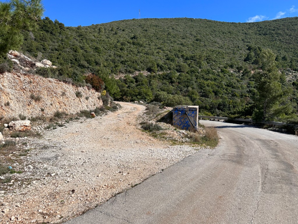
The trail descends down the hill. Keep straight on at all turnings keep heading south and down along the coast. After about 1.5km you reach a track turning sharp right just above a new cluster of small villas. Take that track down past the villas to a road.
Turn sharp left to the track descending down and past some new small villas.
You meet a tarmac road where you turn left. This road runs to the famous Porto Katsiki beach which attracts quite a few visitors in summer. Fortunately you only go 200m.
Turn left onto the track just before the concrete water tank.
The road goes round a corner to the left where a track goes left just before a concrete water tank. Take the track that slowly climbs up across the hill round the top of the bay towards a phone mast near the top.
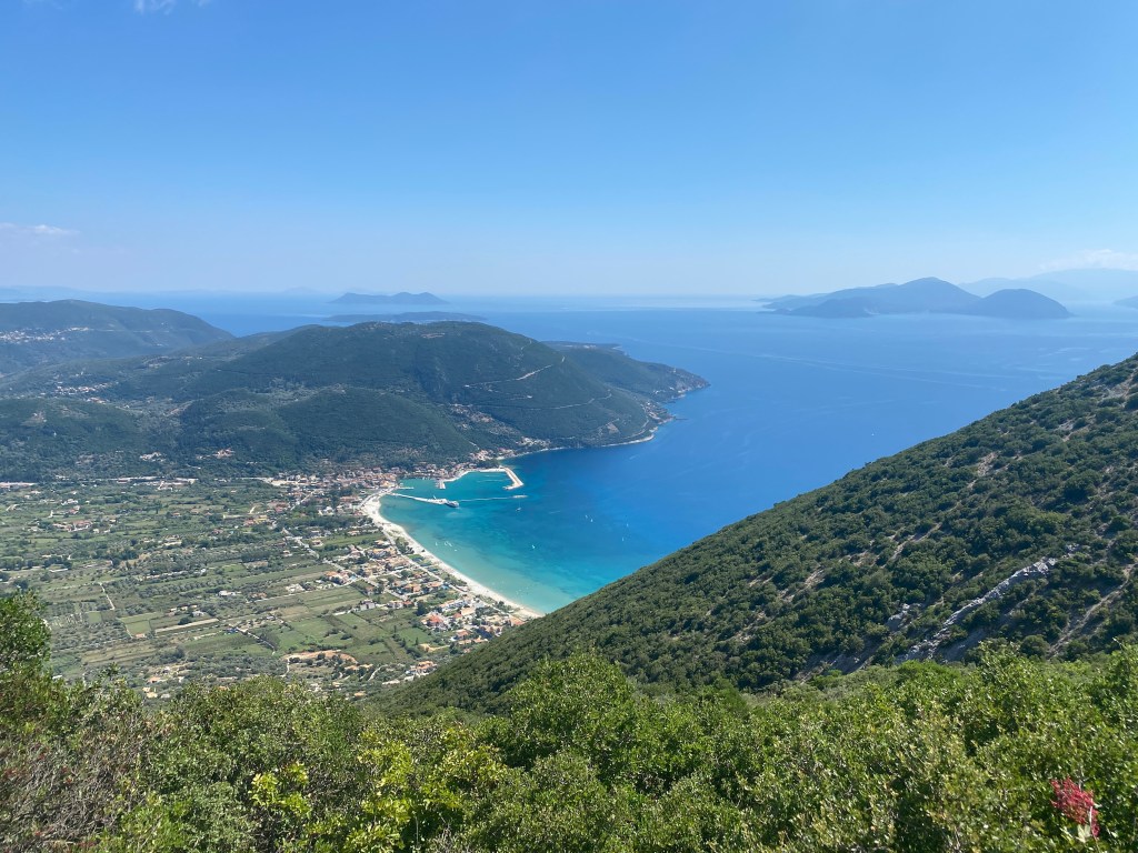
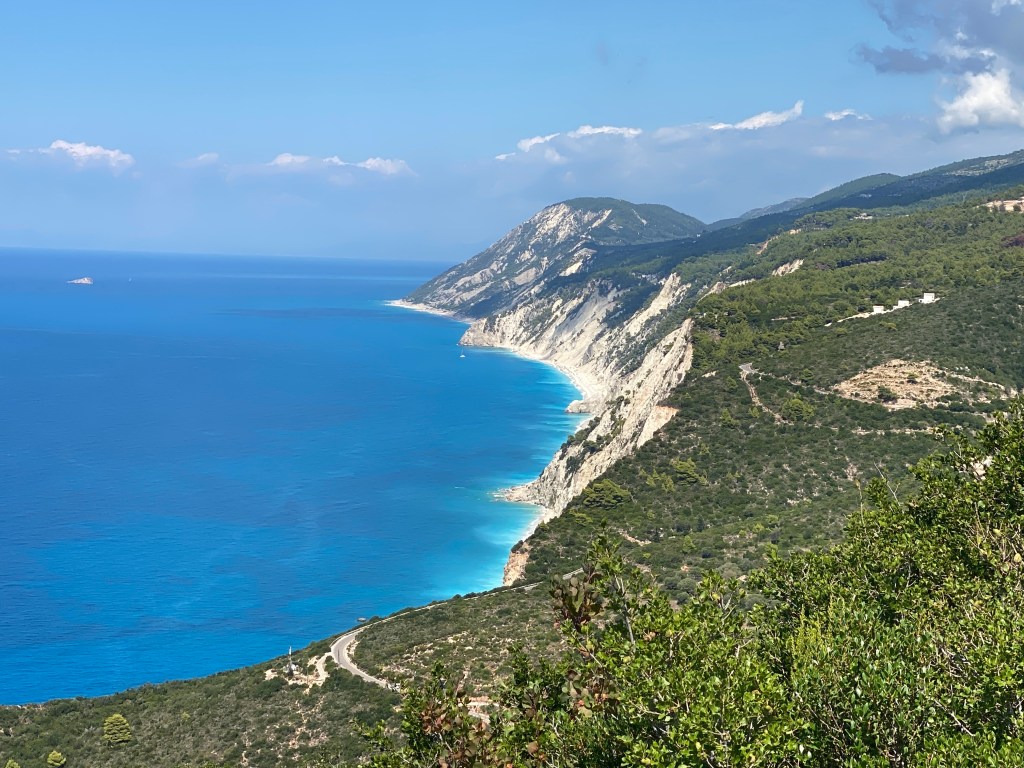
The cliffs, turquiose sea and beaches of the west coast of Lefkada
When you reach the phone mast take a look back for a great view of the west coast of Lefkada – with its white cliffs cascading down to turquoise seas and golden beaches. Turn back south along the track another 50m for the opposite view south. Now you see your destination with the lighthouse at Cape Doukato with Ithaca and Kefalonia beyond.
The last 5km ahead down to the cape and the end of the trail
Take the short track right to join the tarmac road going right. After 50m the road hairpins to the left and a path takes a shortcut right to join the road again and the next hairpin further down the slope. You now rejoin the road and almost immediately take a turning right towards the cape.
You now follow the road for 5km to the cape. The long tail of the island is very narrow (almost a knife edge in parts) and so only really room for the road. The views are stunning to compensate. Keep one eye watching for cars heading for the cape.
The knife edge road approaches the lighthouse on the cape
Just before you reach the lighthouse car park a track goes off to the left running below and parallel to the road. That track continues past the car park and continues the last few hundred metres over the rocks to the cape itself. If you miss the left turn take the track at the end of the car park and scramble left down to the track before it gets to the cape.
The white cliffs of the cape have been a landmark (or rather seamark) for centuries. They showed the way as boats headed too or from Italy and Sicily. “Lefkas” is greek for “white”, and so likely gave the island its name. A temple to Apollo once stood here, now just a few rocks left. It was said that Zeus used to rest here between his many love affairs. This lead to the belief that throwing oneself from the cliff would “cure” unwanted love. The goddess Aphrodite and the poet Sappho both attempted the feat. Neither survived, so in some senses it worked. Not recommended though.
The end of the trail at Doukato Point
Sit down. Have a celebratory drink / chocolate bar / cheese pie – whatever you have. Take in the view across the sea and also consider what you have seen and achieved over the last six days. Well done, you join the roll call of the Lefkada Trail veterans.
Best plan is to arrange for a friend, partner or taxi to collect you from the lighthouse car park. Take a look at the lighthouse and the impressive cliffs to the west of the cape as you wait for the lift. If uber fit you could walk back to Vasiliki sticking to the road – or back to Porto Katsiki beach to pick up an infrequent bus. But I think you have earnt a taxi.
Do tell us about it on Instagram @lefkadatrailsor Facebook. We will use your experience to help improve this website and guide future trail walkers. Not only that, but the early pioneer walkers of the whole trail that tell us online will get free T shirts.
Free T shirt for the early walkers of the whole trail