

This walk runs between the mountain villages of Karya and Eglouvi. It climbs over Profitis Ilias which is a church set on a mountain top with one of the best views in Lefkada. Warning – there are hundreds of churches on peaks in Greece called Profitis Ilias. This is the 1,009 metre peak just SSW of Karya. The trail then descends down the other side to the village of Eglouvi. The trail is along monopati and unsurfaced tracks for almost all of the route.
The trail is the third part of the Lefkada Trail. It is a relatively easy short day on the Lefkada Trail – but then tomorrow, day four, is one of the hardest. You can walk it as a stand alone and walk back a different route to Karya. It is a steep climb up Profitis Ilias mountain and a steep rocky descent to Eglouvi.
Start from the town square in Karya, with all the nice tavernas and the shade of the plane trees.
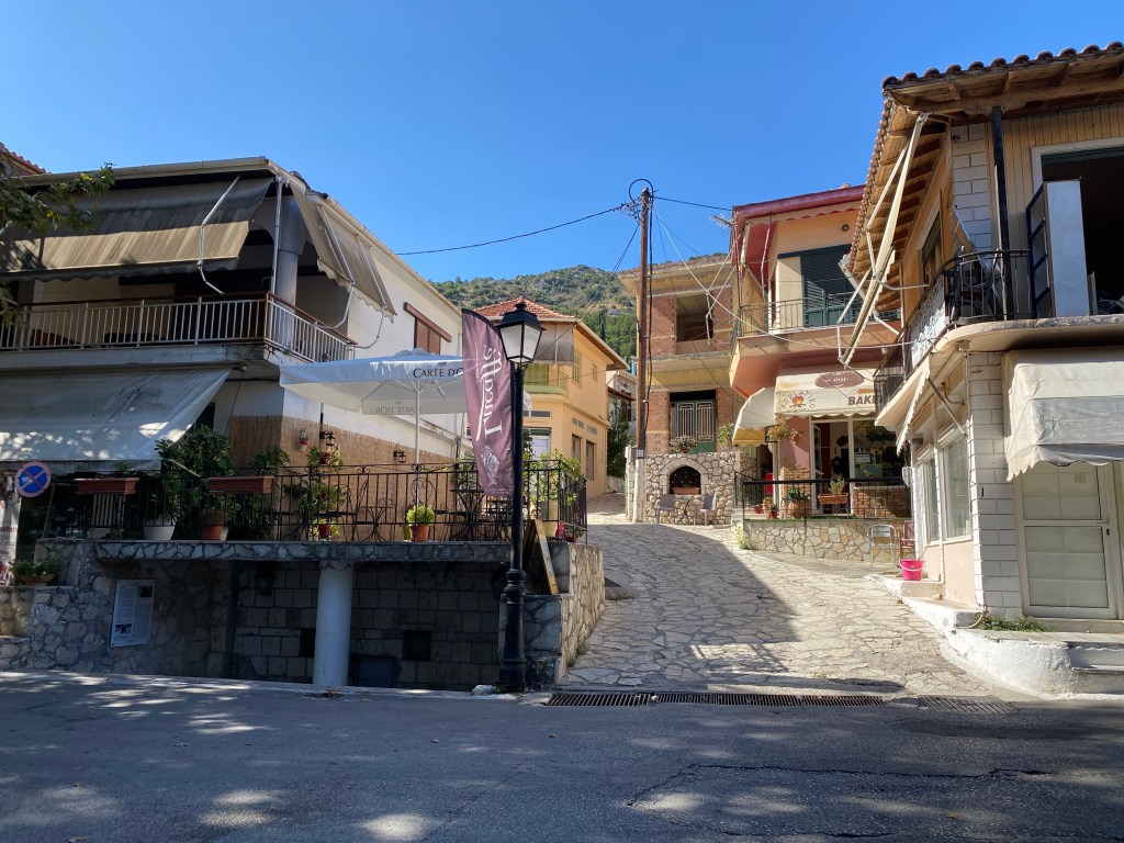
This trail is marked as M4 from Karya – with red markers and arrow signs for most of the way. Go up the steep path/ narrow lane in the north west of the square, by the drinking well. There is a good baker as the path starts where you can get cheese pies for the top.

Follow up through the steeply climbing streets going straight up – but bear a little left at first and then a little right. The path narrows and reaches a turning right up stairs. The M4 red arrows show you the way.

At top of stairs you reach a road. Turn right and go a short distance to a monopati heading up the hill left.

The monopati zig zags up the hill passing through ruined stone buildings and past a small church. The path then goes left to meet a road on a sharp bend. Go up the road until a T junction where you turn right. Very soon a monopati starts up the hill on your left.
Follow the really nice monopati up the mountain. It passes a wonderful natural amphitheatre full of olive trees. Keep going up through some rocky outcrops (but with a good path to keep you safe). The path is well marked by red-yellow paint marks.
As you come to the top of the hill another path joins from the right. The markers now become red-yellow-blue. At the top go left following the markers (there is a less distinct path continuing straight on down to Eglouvi direct).
When you reach the top of the ridge the vista west will open up. Below you is a quarry and over beyond that to the left is the old American communications base. Follow the red-yellow-blue markers up along the ridge until you reach a road heading up the mountain. Go left up the road.

Climb the twisting road up towards the top of Profitis Ilias. The odd car ventures up here, but it is being undermined by the quarry, and difficult to pass. As a walker you won’t have any problem. Stick to the road all the way to the top.
Reach the mountain top and the very pretty church of Profitis Ilias with its amazing views in all directions. Many describe this spot as being close to heaven. You can see all of the Inland Sea from here – on a clear day to the entrance of the Gulf of Corinth.
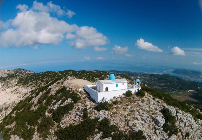
Note that this peak is a drone-free zone. And you can see why many would fly drones here if permitted.

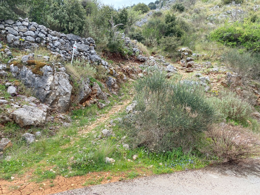
Head back down the road you came up. After about 100m there is a large red and yellow arrow indicating a footpath off left. Descend that path down towards the quarry. The path skirts a small field and then almost gets back to the road. Instead go straight down the slope left. The path is clearly marked with red and yellow paint markers.
Cross the quarry keeping to the path. At the bottom you meet another path coming from the right. You head down the dry streambed to the left. Again, follow the painted markers.

The junction of the A3 (coming from Profitis Ilias) and M4 (going to Karya)
The path becomes steep and rocky so take care. As it steepens the path takes the right hand side of the stream or gorge.

The path eventually meets a road on a hairpin bend. Go down left towards Eglouvi. After a short way paint markers show a path leaving the road and running down into the village. Take this path following back down the A3 trail. If you miss the path the road goes to the village too.

Eglouvi village has three or four tavernas in the main square up a little on the right. Sit in the shade of a wonderful plane tree and relax. There is some accommodation in the village and an infrequent bus to Lefkada Town. Day four of the Lefkada Trail will take you up over Lefkada’s highest mountain and down to the south of the island.
I walked this many times during my stay on the island as it was my favourite walk. However, after following the path up to Profitis Ilias I decided to walk back to Karya via the road, as the path was overgrown and seemed to frustratingly double back on itself constantly.
My favoured route was the road up from Karya (via the air force station) to Profitis Ilias, then back down to the road to Englouvi . From here I walked on the principal road back to Karya for a cracking workout. I prefer roads as long as they are quiet as these roads are (at least in September anyway).
Richard (walked in early Sept 25)